September snowstorm, blizzard to dump feet of snow in West
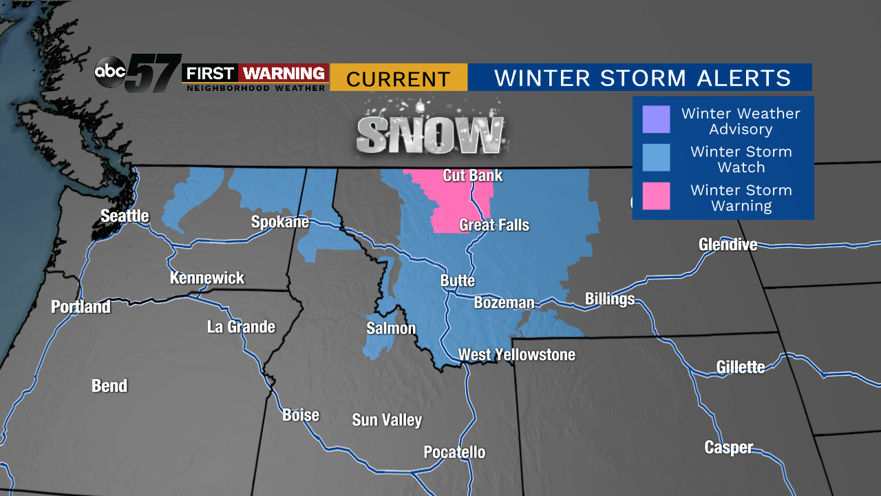
An unusually cold and active period will support accumulating snow across parts of Montana, Wyoming, Idaho, Washington, and Oregon. The heaviest of the snow will likely fall across the higher elevation areas of northern Washington, Idaho and much of Montana.
That is where Winter Storm Watches and Winter Storm Warnings have already been issued by the National Weather Service.

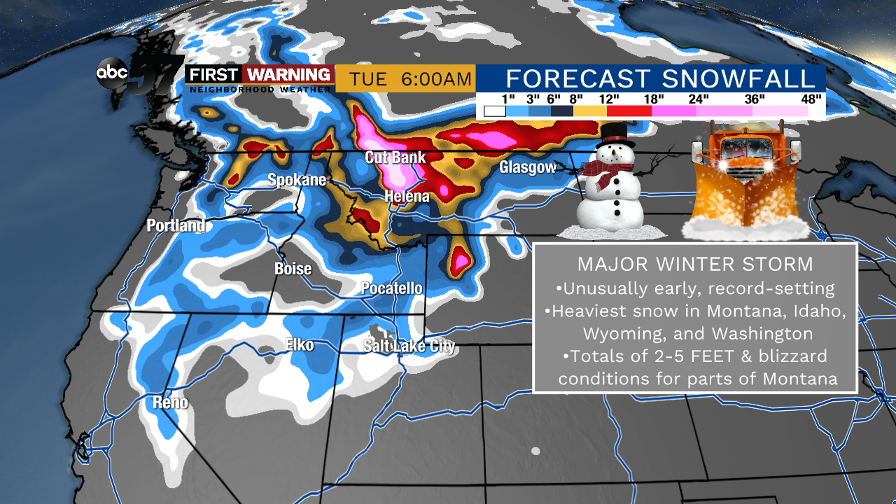
The higher terrain of Washington, Idaho and Montana could see upwards of 12-18" of snow with parts of North Central Montana expected to see 3-4 feet of the white stuff!
According to the National Weather Service in Missoula, here are the potential threats where the heaviest snow falls:
- Hazardous to impossible travel
- Life-threatening backcountry conditions
- Downed trees and power lines
- Wind damage and agricultural damage
Here's the strong wording used by the NWS in Great Falls to describe the impending winter storm:
"This early season winter storm and/or blizzard has the potential to set a new benchmark for snow accumulations, cold temperatures, and resulting impacts for parts of the Northern Rockies and the Rocky Mountain Front."
The storm could wind up being record-breaking and historical once all is said and done.
