The cold comes slamming back this weekend
Posted: Mar 1, 2019 4:43 PM EST

-
3:15

Saint Mary’s College hosts sports clinic for girls in honor...
-
4:12

The Red Event celebrating in South Bend
-
1:55

MAAC Foundation’s S50 K9 fund strengthens local police K9 units
-
1:47

Freezing rain moves in tonight, expecting slick roads tomorrow...
-
1:24

Happy feet hit the floor at 24th Annual Daddy Daughter Dance
-
3:35

New house bills could reorganize local school corporations
-
1:58

New era underway at Knollwood Country Club
-
3:51

Local Police Departments concerned over House Bill 1186
-
2:55

’Save Lakeside Woods’ successfully buys land back from developer,...
-
3:26

SBCSC announces community partnership to improve school literacy
-
2:21

Freezing rain reaches Michiana Wednesday night
-
2:25

Potential ice jamming in New Buffalo

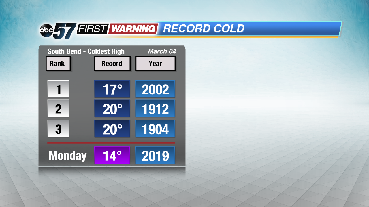
Cold air slams back into Michiana this weekend. Temperatures peak in the mid-30s Saturday, then fall steadily through Tuesday of next week. A few chances for snow but total accumulation through the weekend looks minimal. The chance of snow continues through Tuesday. Near record lows are still possible Monday and Tuesday morning. There is a slow warm-up through the rest of the week but temperatures remain below normal.
Tonight: Mostly cloudy, chance late of snow late, low of 26.
Saturday: Mostly cloudy, early morning snow showers, high of 34.
Sunday: Light snow, high of 28.
Monday: Cold, chance of snow, high of 14.

Sign up for the ABC 57Newsletter