Hot and humid weekend with isolated storm chances

-
2:06

The threat for severe weather has increased
-
2:16

More sunshine today with a severe risk tomorrow
-
0:32

Granger residents share input on proposed S.R. 23 roundabout
-
2:59

Seven local boards unanimously approve fire territory merger...
-
2:05

JobSpark helps inspire career exploration for middle school students
-
2:01

MPHPL launches new bookmobile to extend library access
-
2:17

Will Pauling shines, Jadarian Price shows versatility at Notre...
-
2:55

Notre Dame’s Pro Day gives 16 seniors one more shot to impress...
-
2:57

South Bend residents voice concerns over proposed pedestrian...
-
3:03

Prices at the pump continue to rise across Michiana
-
1:35

Warming up before storms arrive Thursday
-
1:06

Alliance for the Great Lakes publishes ’Data Center Playbook’

ABC57 First Warning Neighborhood Weather
Friday, July 17th, 2020
Areas of patchy fog this morning, otherwise plenty of sunshine today with a high of 88F. We’ll have pretty clear skies again tonight for those hoping to catch a glimpse of Comet NEOWISE.
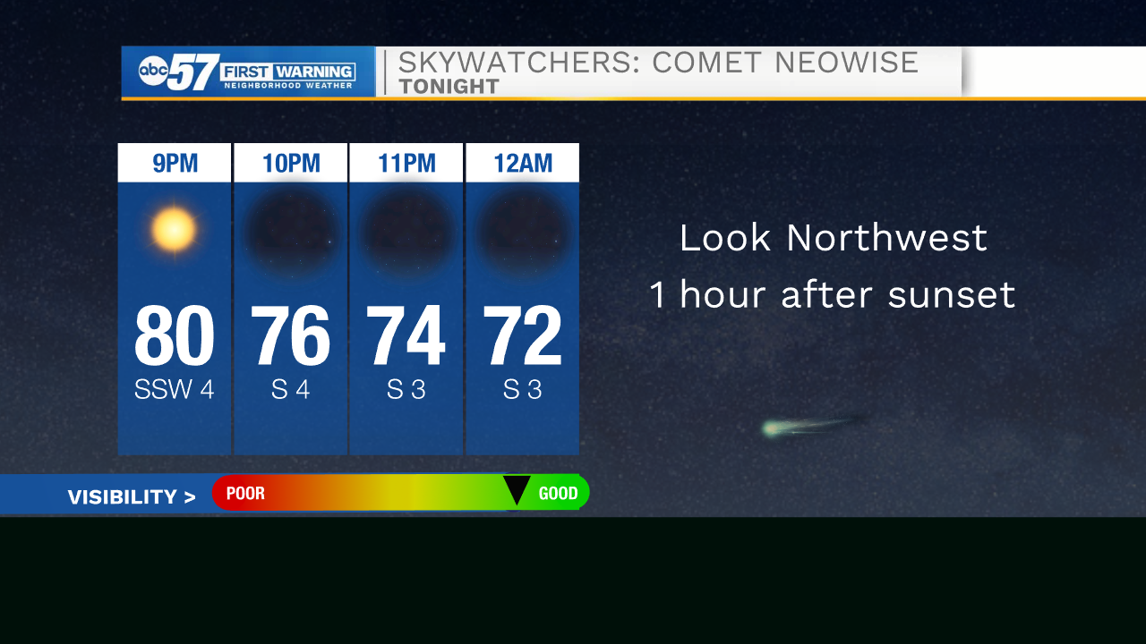
SKYWATCHERS: Comet NEOWISE gracing the night sky
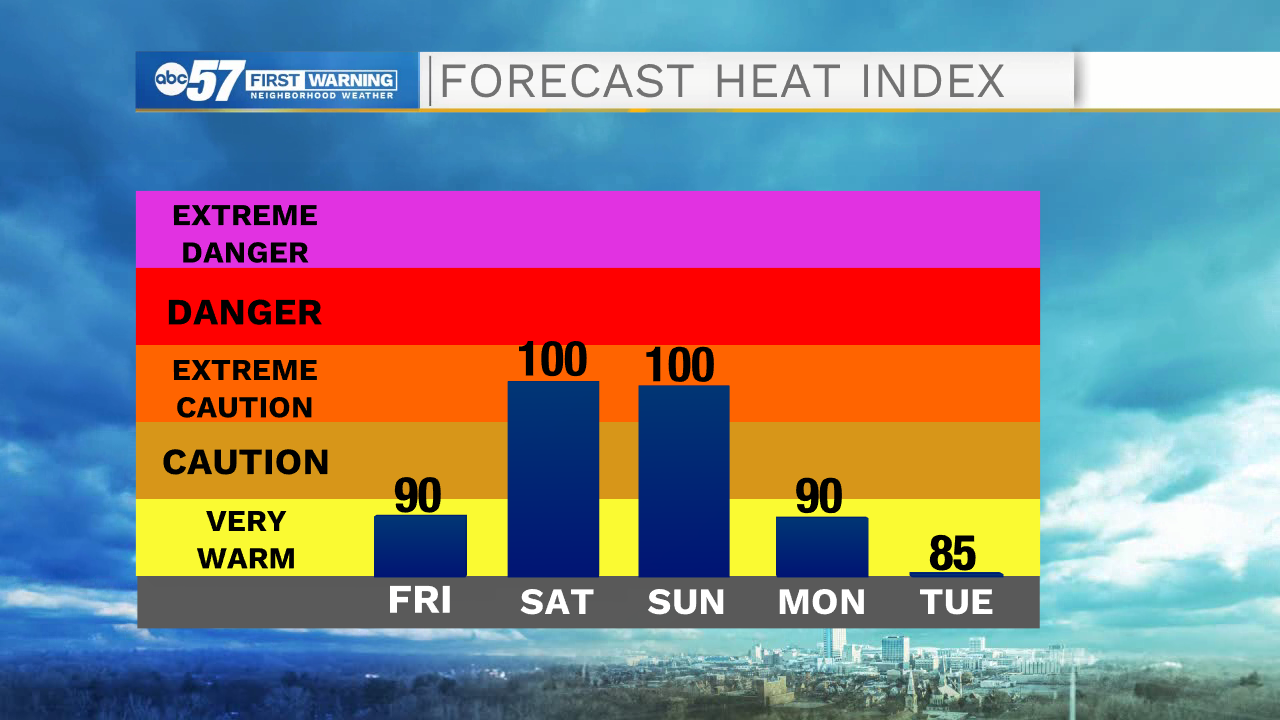
It continues to heat up with weekend with heat indices ranging from 95-100F. An isolated shower or storm is possible Saturday but a couple of showers/storms are more likely Sunday as a weak cold front passes through. More isolated shower/storm chances Monday and Tuesday. Daytime highs will be more comfortable in the mid-80s.
Today: Mostly sunny. High 88.
Tonight: Mostly clear. Low 68.
Saturday: Partly cloudy, stray shower or storm. High 93.
Sunday: Partly to mostly cloudy, isolated storms. High 92.