


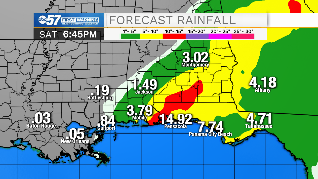
Heavy rain, flooding and very strong winds continue to batter the Gulf Coast Tuesday evening, with Hurricane Sally slowly moving towards shore.
Because of the slow-moving nature of the hurricane, some locations in Alabama and Florida could get upwards of 15 inches of rain by Friday.
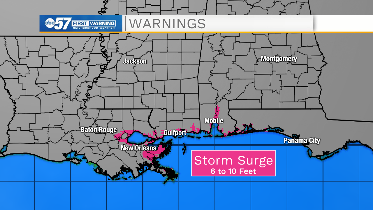
Storm surge is also a big problem with Sally. As the storm continues to churn in the Gulf, Sally is pushing a lot of water on shore, creating coastal flooding and erosion concerns.
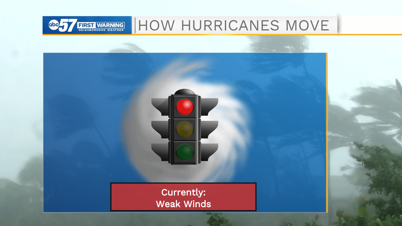
So, why is Sally stalling so much? For the answer, we have to look at how hurricanes move in the first place.
In general, tropical cyclones move with the atmosphere's steering (or mean) wind. Hurricanes truly do "go with the flow," and they like to be relatively undisturbed by wind shear.
However, sometimes (like this week in the Gulf), the steering wind flow is VERY weak. In that case, hurricanes have nothing to guide them, so they basically stay put.
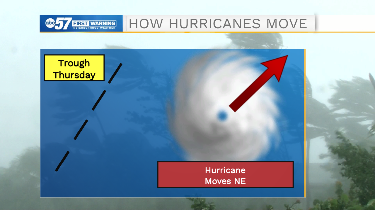
However, the track of Sally is expected to shift to the northeast on Thursday and Friday once a trough (cold front) arrives. This will change and strengthen the steering flow and send Sally into Georgia and South Carolina.
Now that you know how and why hurricanes move, the "cone of uncertainty" hopefully makes a lot more sense!