Wet snow starts Wednesday evening, lasting through Thursday morning
By:
Tom Coomes
Posted: Feb 4, 2020 4:35 PM EDT

-
0:51

Groundbreaking at new Elkhart apartments Thursday
-
0:49

One dead after hit and run with motorcycle in Elkhart Thursday...
-
1:12

Marshall County Historical Society & Museum holds annual fundraiser
-
5:48

Local author’s new book makes reading fun
-
1:39

Severe weather possible amidst several rounds of showers and...
-
2:23

Pulaski County Historical Society giving history a new home
-
1:14

The 24th Annual Cops Cycling for Survivors makes its way to South...
-
2:02

Storm threat increasing for Michiana Friday and Saturday
-
5:14

’Pollinator Promenade’ celebrates local pollinators
-
1:48

Nothing notable on Thursday, but showers and storms to end the...
-
4:01

Benton Harbor bringing mobile nuisance party ordinance back to...
-
0:52

Board votes 5-2 to keep Clay High School Building

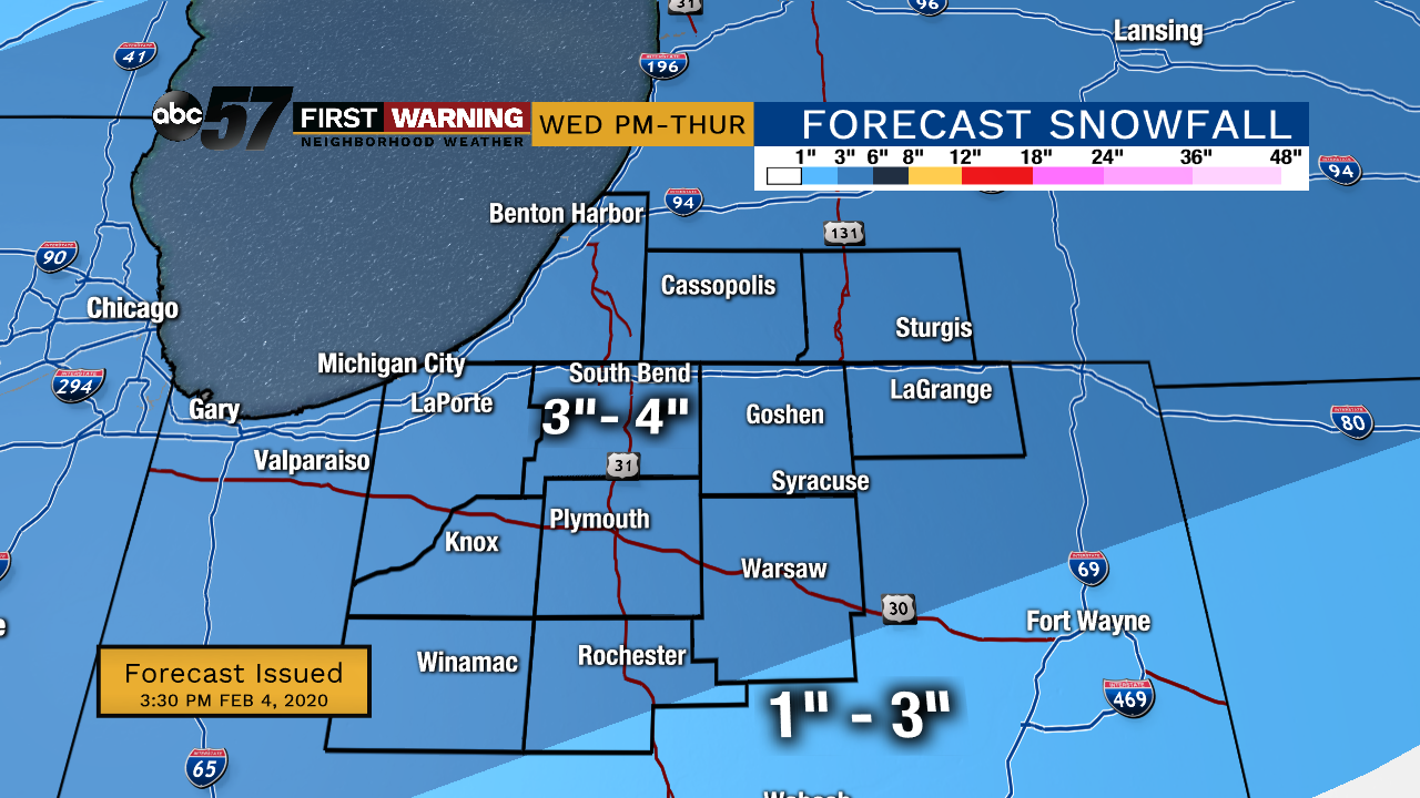
Wednesday will be cloudy but snow-free until the evening. The greatest chance of snow is Wednesday evening until midday Thursday. We could see more than three inches of wet snow. Allow extra time for the Thursday morning commute. There is a chance for lighter snow showers Thursday evening into Friday morning but will less of an impact. The rest of Friday is mostly cloudy. Temperatures this week stay in the low 30s each day and drop to the low or mid 20s each night.
Tonight: Cloudy. Low 29.
Wednesday: Cloudy day, PM snow. High 33.
Thursday: AM snow, PM flurries. High 30.
Friday: AM flurries then mostly cloudy day. High 30.
Sign up for the ABC 57 Newsletter