Very strong winds, big-time waves to cause 'worst impacts seen in many years'
Posted: Oct 16, 2019 10:56 AM EDT


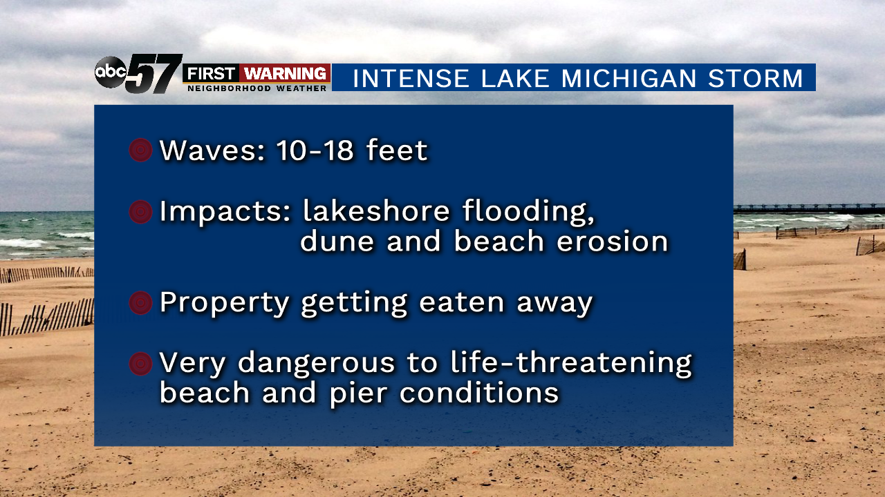
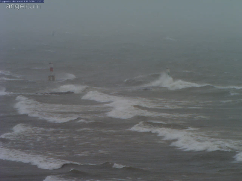 Holland, Michigan, with waves of 12-18 feet at 11:30 a.m. Wednesday.
The lake simply looks like an ocean during a tropical storm.
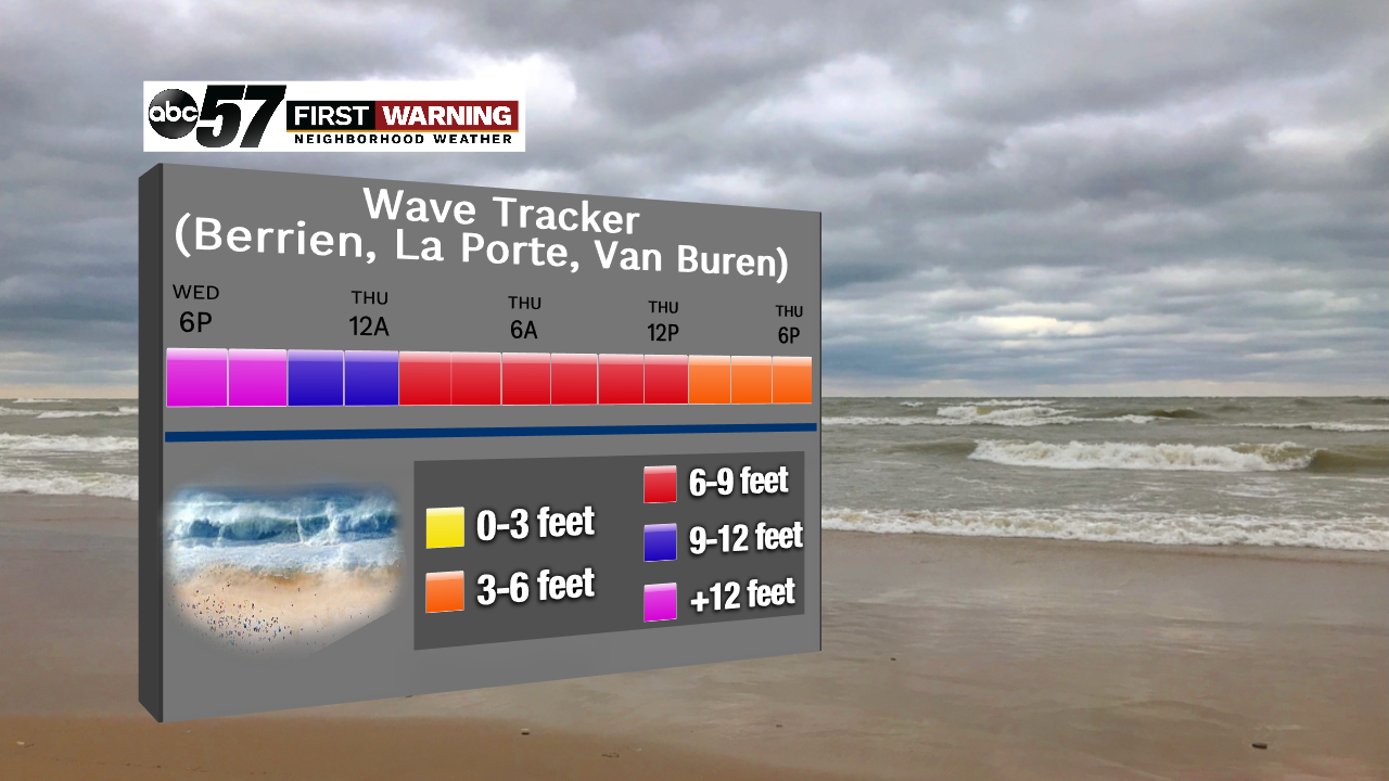
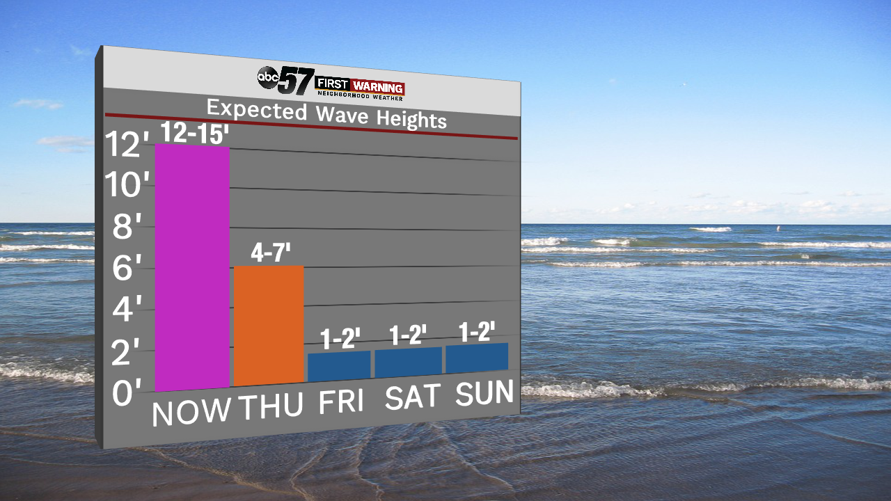
Fortunately, the event will not last long. By Thursday afternoon, waves will be under 5 feet at nearly all beaches up and down Michigan's western shore.
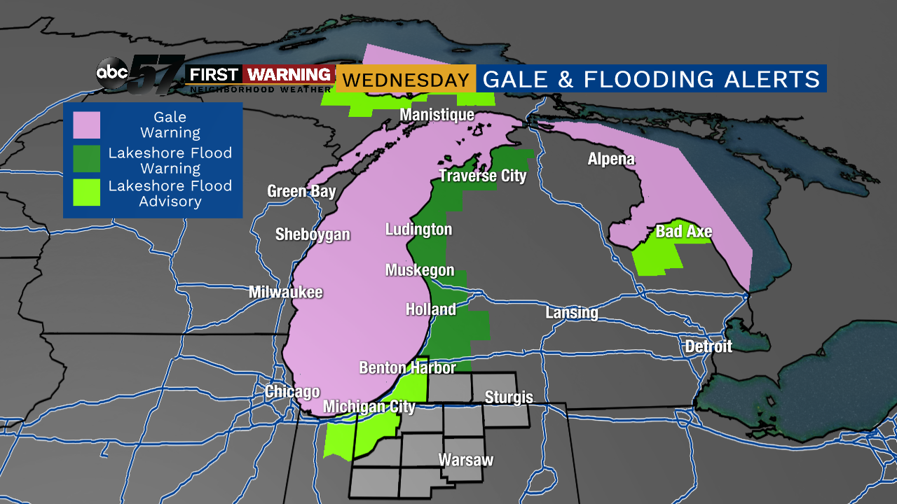
Gusty winds and high waves today with some lakeshore dune and bluff erosion. Scattered power outages could occur near the coastline. #wmiwx pic.twitter.com/0jJnt5RYRD
— NWS Grand Rapids (@NWSGrandRapids) October 16, 2019
As always, if you snap any photos or take any videos, be sure to send them on in if you can do so safely!