
-
0:19

Liberty Township holds meeting for community members to voice...
-
0:41

Marshall County Humane Society’s cats look forward to celebrating...
-
1:56

Memorial walk for Elkhart teen killed in police involved shooting
-
10:02

ABC57 digs into rising utility bills causing regional outrage
-
1:05

A big warm up begins Friday
-
3:39

What do you do after suffering a heart attack?
-
1:44

Cloudy and cool today, Warmer next week
-
2:34

Local Michiana soccer clubs merge, an idea in the works for over...
-
2:36

Elkhart Police Chief and Mayor hold press conference following...
-
3:58

Elkhart officials urge patience as investigation continues into...
-
2:43

VSBM Releases record-breaking 2025 report
-
3:23

Pointe Apartments owners face demolition despite claiming to...

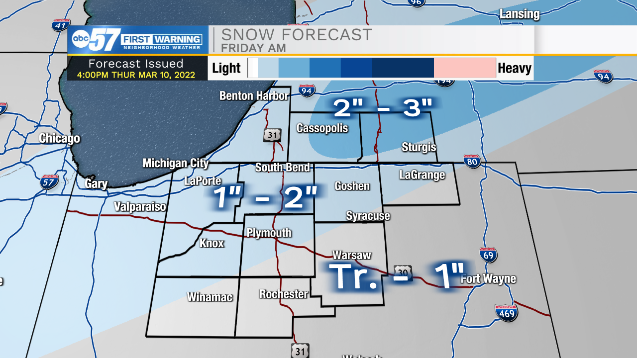
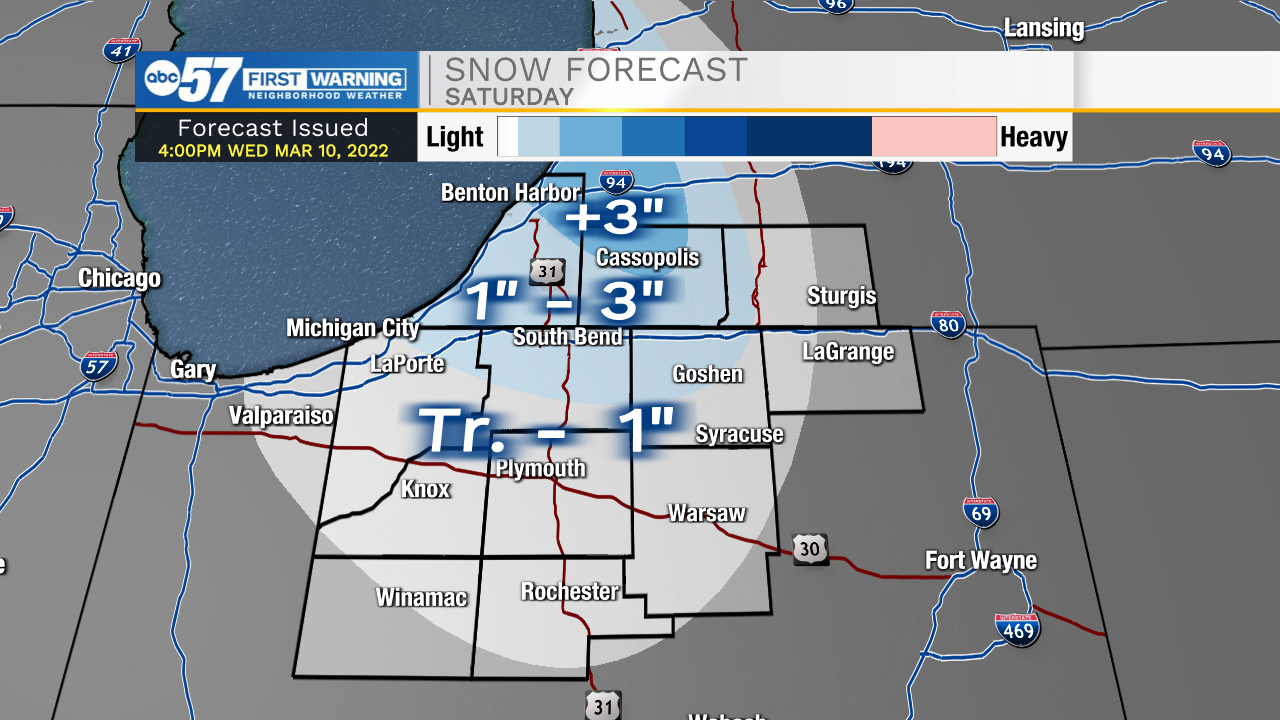
Friday will start with a couple inches of snow on the ground, roads may be more wet than snowy, but don't underestimate the snowfall as roads may be slick. There's no snow the rest of Friday, and pavement likely clears as temperatures warm into the mid-30s. Friday night through Saturday is cold and windy. Wind gusts top 30 mph and the wind chill nears zero Saturday morning. Lake effect snow showers could bring an additional one to three inches to the snow belt. All will be forgotten by Sunday, with sunshine and highs near 50!
Reminder: Daylight Saving Time begins at 2:00 a.m. on Sunday, March 13. We spring forward one hour.
Tonight: Snow showers. Low 24.
Friday: Snow ending, Becoming windy. High 36.
Saturday: Cold, windy, lake effect snow showers. High 24.
Sunday: Partly cloudy, breezy. High 50.