
-
1:43

Pleasant to start the weekend
-
3:06

Pulaski County weighs stricter solar rules amid resident concerns
-
0:40

Marian High School hosts World Down Syndrome Awareness Walk
-
2:33

South Bend leaders call for an end to gun violence
-
2:01

Tae Johnson, Notre Dame secondary stands out as Irish open spring...
-
2:21

Backup quarterback competition, position battles highlight Notre...
-
2:25

A new Pathway to the Golden Dome
-
2:33

Howard Park aims to install bandshell
-
1:37

March Madness and gambling responsibly
-
1:19

There are two big temperatures drops next week
-
1:48

Longer days for the first day of Spring
-
1:30

Country music star Jake Owen to play at Blue Gate Performing...

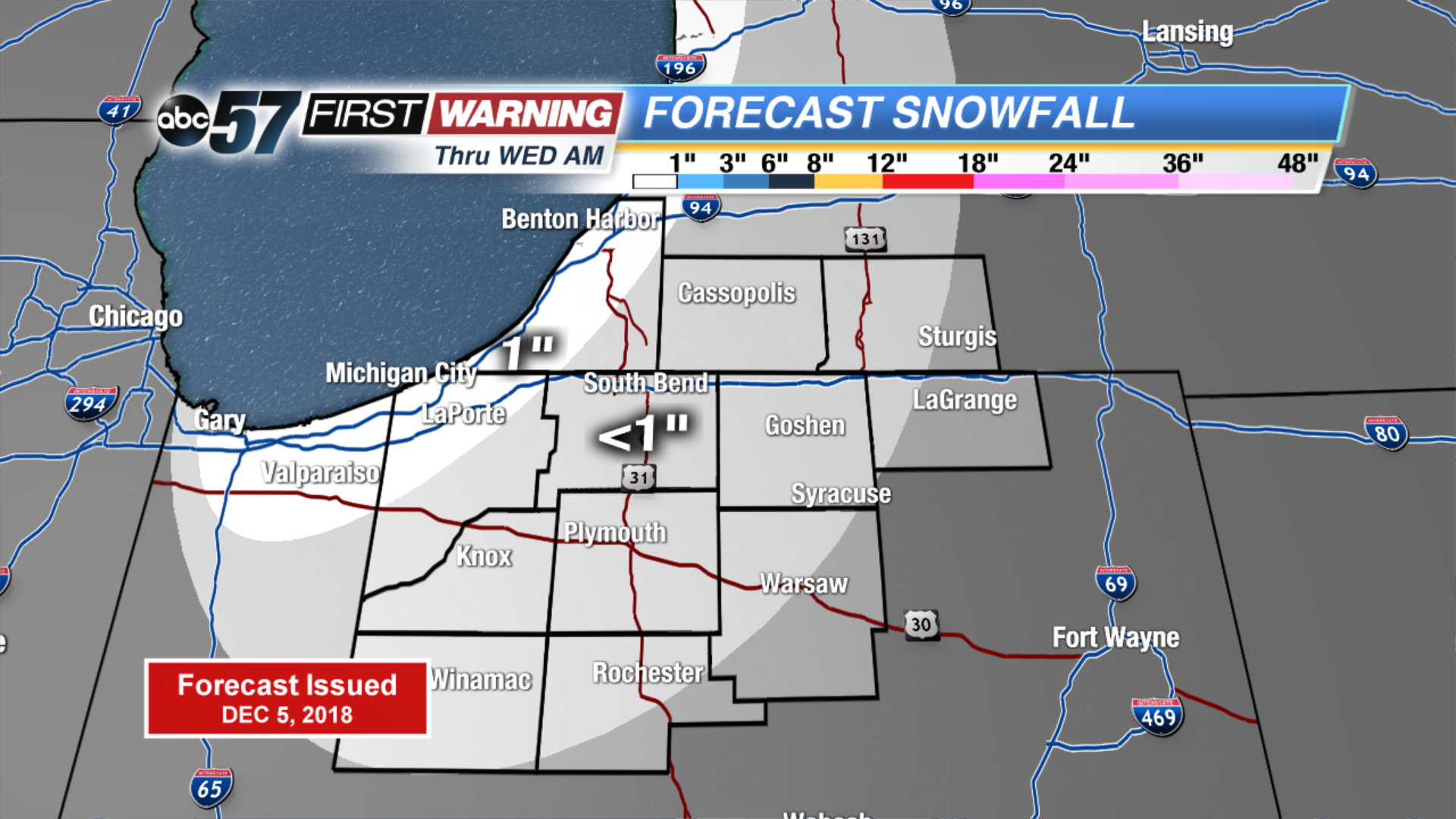
Light lake effect snow showers start Wednesday, up to an inch of accumulation is possible. The wind changes direction ahead of cold front but temperatures do little warming. Light snow is likely again Thursday morning, early estimates still on the order of around one inch. Major change to end the week, the forecast is still cold but sunshine looks to dominate the forecast through the weekend. Next week trends milder.
Tonight: Mostly cloudy with a chance of lake effect snow showers. Low of 24.
Wednesday: Mostly cloudy with lake effect ending early, then partly sunny. High of 32.
Thursday: Light snow early, mostly cloudy and breezy. High of 32.
Friday: Partly cloudy, high of 28.
Sign up for the ABC 57 Newsletter