
-
2:52

McKinnies Realty expansion looks to spread word on Homes for...
-
1:19

Timing out the rain on Halloween
-
2:27

Elkhart County Historical Museum offers community ofrenda in...
-
1:57

Flowers Early Learning battles for childcare needs
-
1:41

A Summer-like stretch of weather ends on Thursday
-
3:04

Michigan voters showing up in droves to election polls
-
1:12

South Bend Common Council looking to annex a portion of the County
-
1:43

Pulaski County enters day 10 of burn bans
-
1:33

Warm and breezy end of to October
-
2:54

Drug overdoses continue to decrease across Michiana
-
1:44

How often is it to see 80 degrees after the first frost?
-
1:34

From just above average today to the 80s later this week

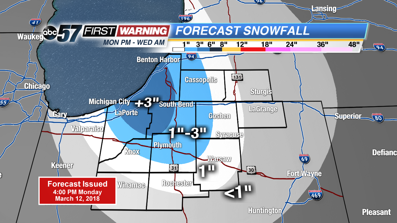
Snow squalls intensify after midnight, accumulation of more than three inches is possible in parts of Berrien, La Porte and St. Joseph counties. Greatest concern will be slick roads for the morning drive Tuesday.
Snowy start to Tuesday, roads may be slick with a few inches on the ground and a coating of snow or slush on the roads. Snow showers wane a bit during the day as temperatures warm towards the freezing mark. Snow showers may bring an additional inch Tuesday night as temperatures fall back into the 20s. Sunshine and a slow warm-up are in store the rest of the week.
Tonight: Lake effect snow showers, low 26.
Tuesday: Lake effect snow showers, high of 32.
Wednesday: Morning snow showers, high of 38.
Thursday: Mostly sunny, highs in the low 40s.