
-
1:43

Pleasant to start the weekend
-
3:06

Pulaski County weighs stricter solar rules amid resident concerns
-
0:40

Marian High School hosts World Down Syndrome Awareness Walk
-
2:33

South Bend leaders call for an end to gun violence
-
2:01

Tae Johnson, Notre Dame secondary stands out as Irish open spring...
-
2:21

Backup quarterback competition, position battles highlight Notre...
-
2:25

A new Pathway to the Golden Dome
-
2:33

Howard Park aims to install bandshell
-
1:37

March Madness and gambling responsibly
-
1:19

There are two big temperatures drops next week
-
1:48

Longer days for the first day of Spring
-
1:30

Country music star Jake Owen to play at Blue Gate Performing...

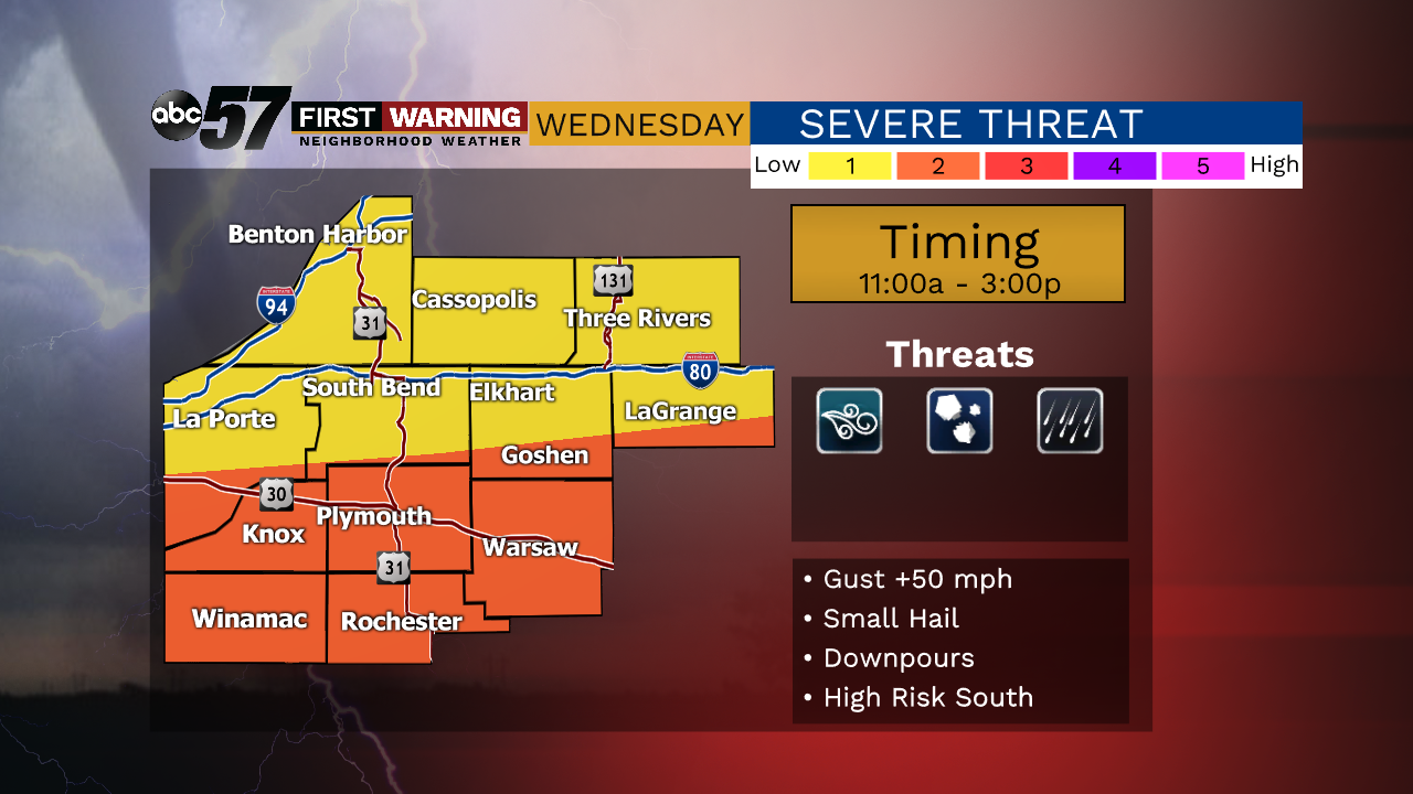
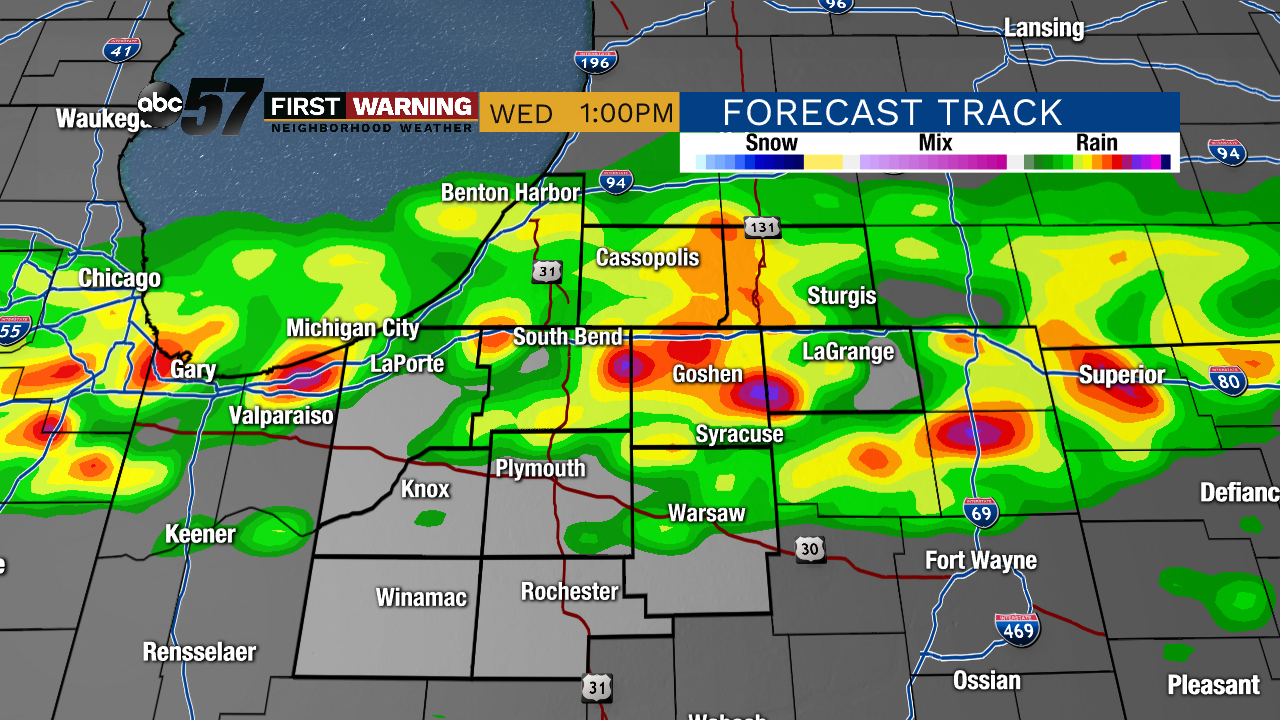
Steamy through Wednesday morning, the high humidity will fuel midday thunderstorms as a cold front cuts southward. The midday timing of storms will limit the severe threat, a threat that increase north to south and is likely highest closer to Kokomo and Indianapolis by mid afternoon. The biggest difference in the wake of this front is lower humidity. Thursday is warm, sunny but not humid. A slight surge in humidity Friday sparks an isolated chance of storms, then a beautiful summer weekend to follow.
Tonight: Muggy. Low 70.
Wednesday: Midday scattered storms. High 78.
Thursday: Mostly sunny. High 84.
Friday: Isolated storms. High 85.
Sign up for the ABC 57 Newsletter