
-
1:43

Pleasant to start the weekend
-
3:06

Pulaski County weighs stricter solar rules amid resident concerns
-
0:40

Marian High School hosts World Down Syndrome Awareness Walk
-
2:33

South Bend leaders call for an end to gun violence
-
2:01

Tae Johnson, Notre Dame secondary stands out as Irish open spring...
-
2:21

Backup quarterback competition, position battles highlight Notre...
-
2:25

A new Pathway to the Golden Dome
-
2:33

Howard Park aims to install bandshell
-
1:37

March Madness and gambling responsibly
-
1:19

There are two big temperatures drops next week
-
1:48

Longer days for the first day of Spring
-
1:30

Country music star Jake Owen to play at Blue Gate Performing...

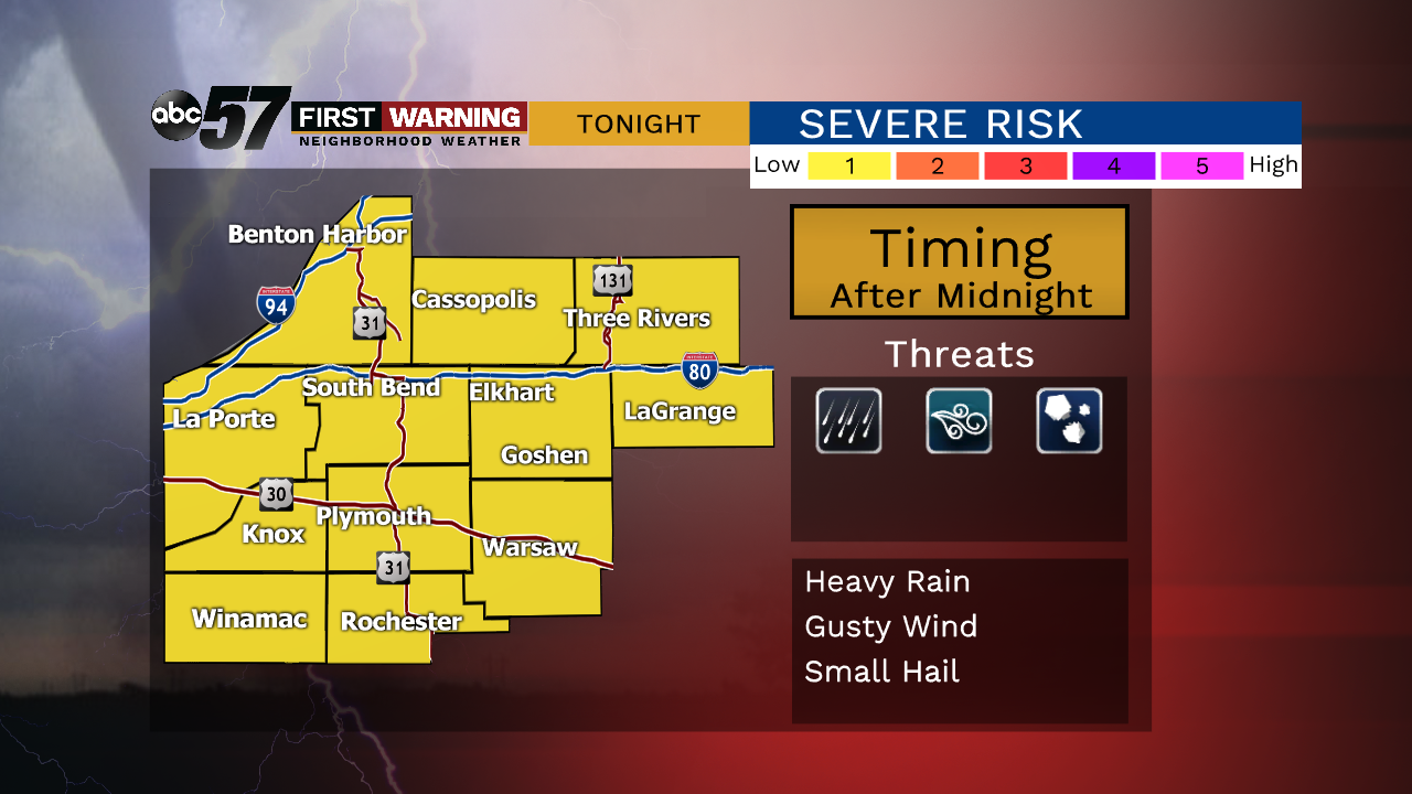
Muggy overnight with scattered showers / storms by morning, some could be loud with thunder, wind and hail.
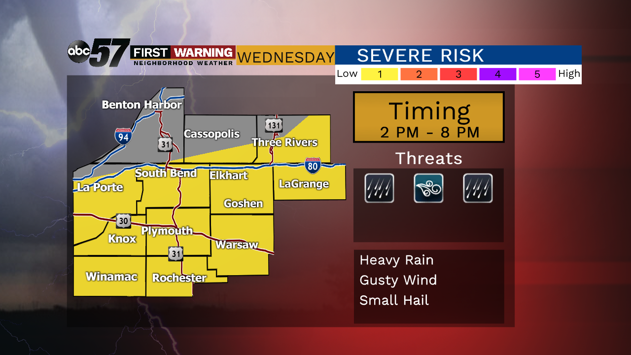
Morning showers and storms Wednesday will play heavily on any afternoon development. The longer clouds linger the less likely a severe storm threat will be later in the day. There will be a lull midday between showers and storms. Then storms develop ahead of a cold front that dives southward across the area. The farther south the higher the severe threat Wednesday afternoon. Skies clear and the humidity drops to end the week.
Tonight: Mostly cloudy, chance of showers/storms after midnight, low of 66.
Wednesday: Morning showers possible, mostly cloudy, then afternoon showers/storms, high of 80.
Thursday: Mostly sunny, high of 74.
Friday: Mostly sunny, high of 78.