South Bend, Ind -- Friday’s high of 83 was not a record, but it is another data point in the climate record showing an autumn warming trend.

Typically the last 80 degree day happens around October 3rd, give or take a few days. Since 2016 that trend has shifted, greatly.

Since 1970 the average date for the last 80 degree day has shifted a week later, from early October to mid October.

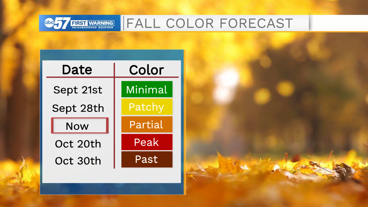
Some may enjoy the later onset of cool weather, it does have impacts on the natural order of things, the most visibly the changing of the leaves.
Peak #fallcolor will be pushed back at least a week due to warm weather ? https://t.co/81y0RPEq1H | #inwx#miwxpic.twitter.com/idDWsNncIN
— Tom Coomes (@TomCoomes) October 8, 2020
Our special report in 2018 Later Leaves continues to validate. Leaves are staying on the trees longer. There was hope 2020 might buck the trend with some cool weather to start the month but the color change is on pause with the mid-month warm.