Isolated showers and storms this morning, More heat this afternoon


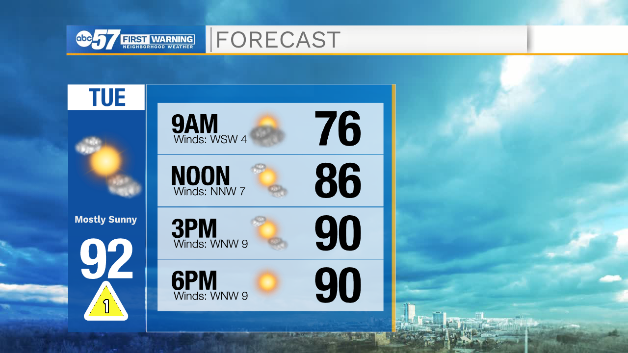
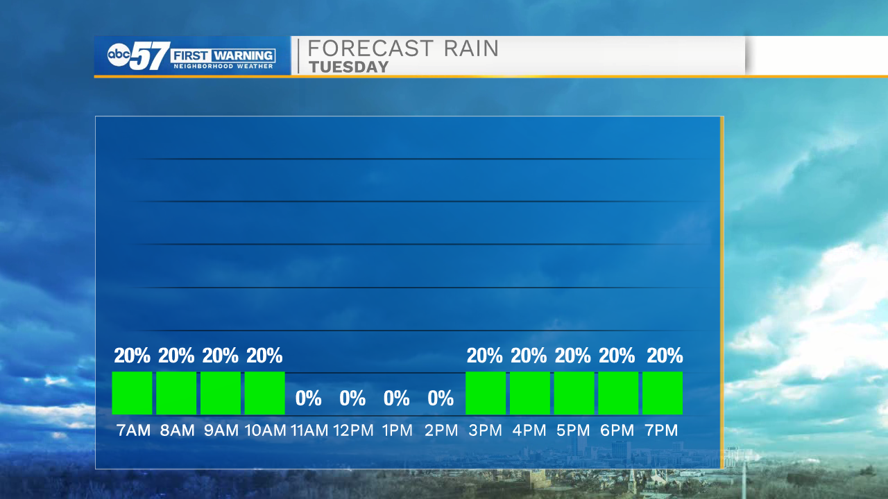
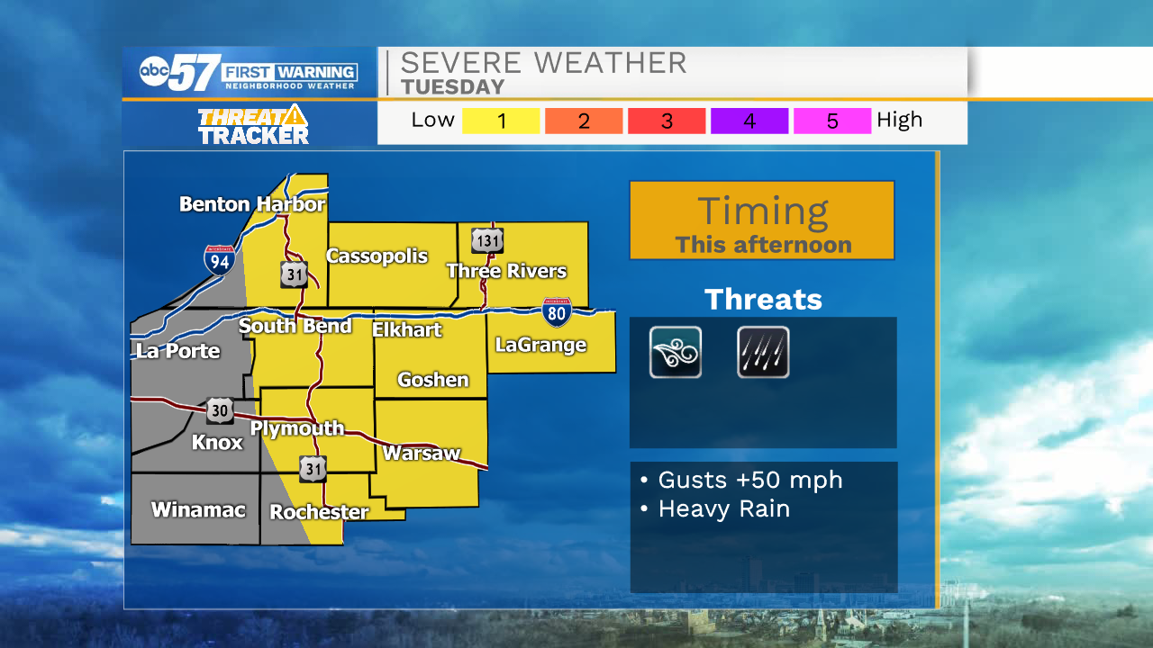
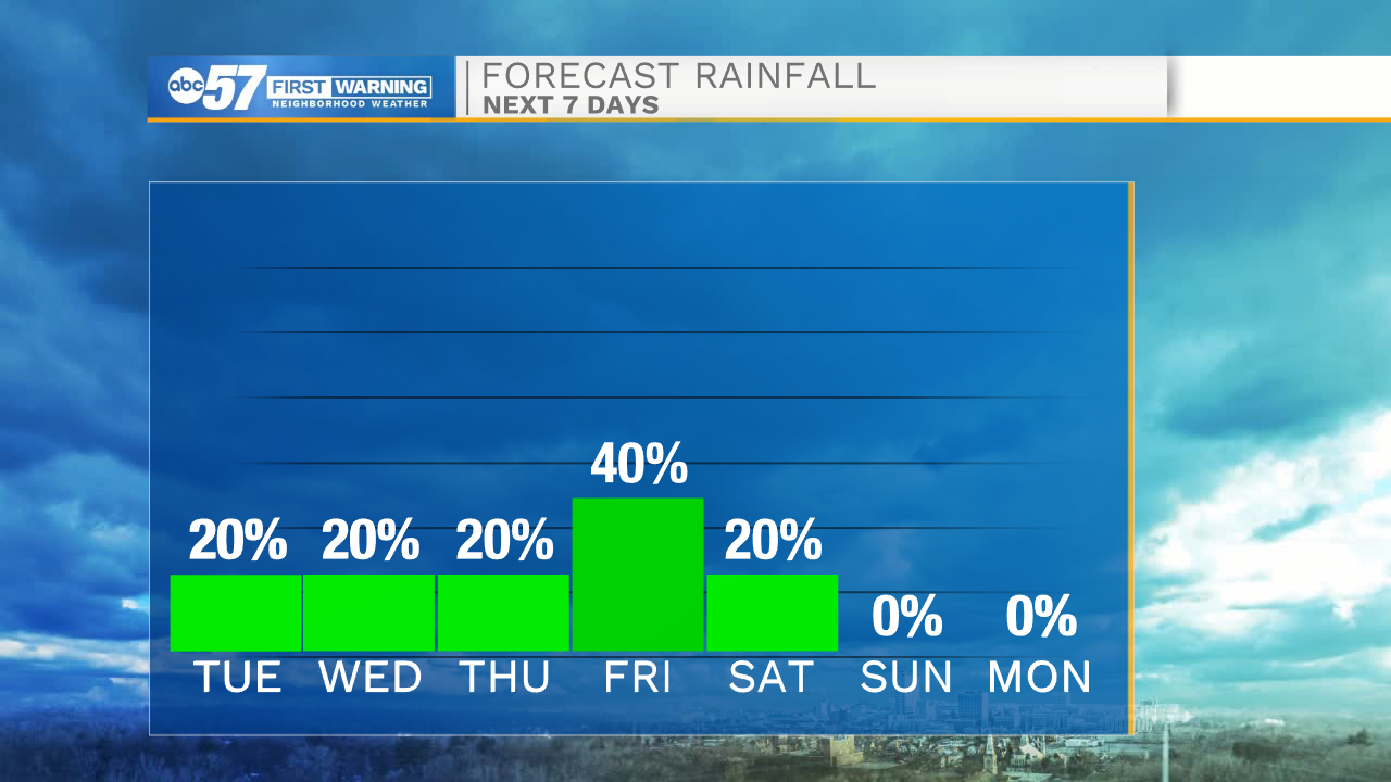
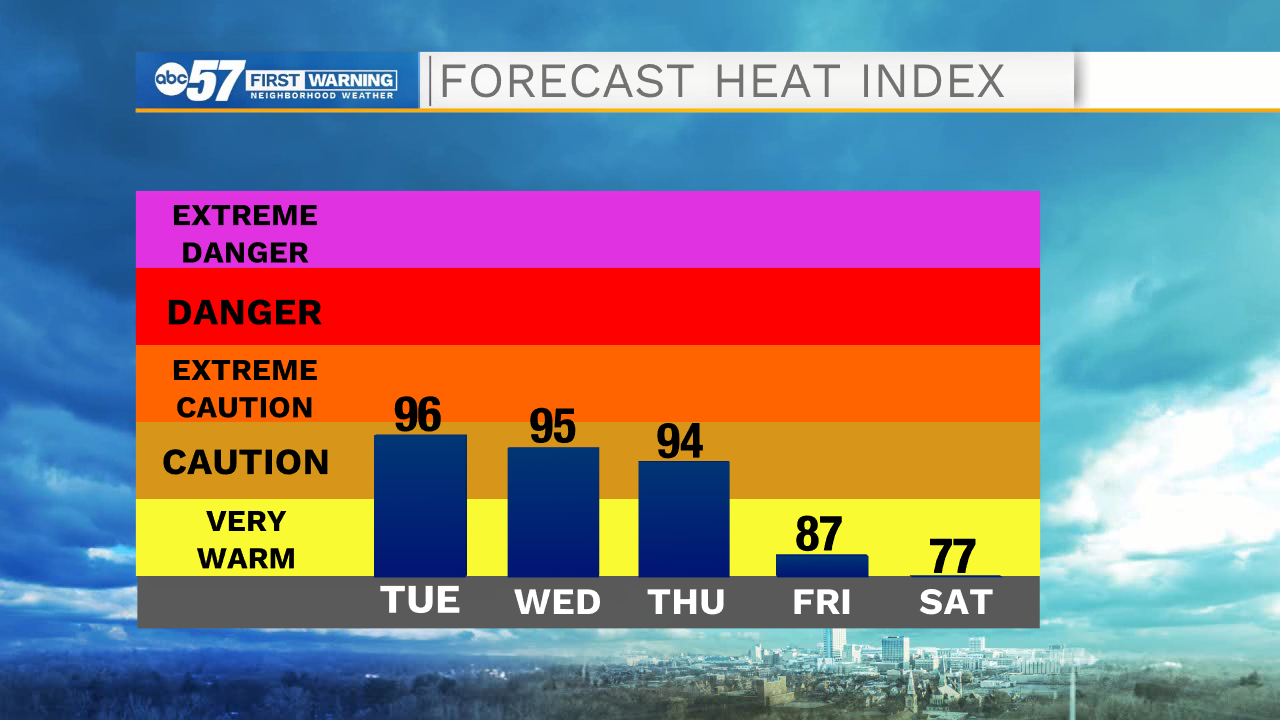
This morning a few isolated showers and storms are possible through 10am. A few of those storms could be on the stronger side, but for the most part will stay sub-severe. After 10am the rain activity will clear as well as any lingering cloud cover. Temperatures this afternoon will warm into the lower 90s with heat index values in the mid 90s. Later this afternoon a few pop up showers and storms will be possible. A stationary boundary will stall to the north of us allowing for more rain and storm development early tomorrow morning. Our southwestern Michigan counties will hold the best chance of seeing those showers. Tomorrow afternoon will be one of the warmest days of the summer. High temperatures will top out around 95 degrees.
Thursday afternoon will be another warm one with highs in the mid 90s. Heat index values will remain in the mid to upper 90s. Friday afternoon a cold front looks to move in helping to drop temperatures into the upper 80s. Along with cooler temperatures, better rain chances will move in as well. Friday night into Saturday morning looks like our best chance for scattered rain throughout Michiana. High temperatures on Saturday will only be in the lower 80s. Sunday looks nice and dry with mostly sunny skies and highs topping out in the upper 70s.
Today: Mostly sunny. High 92.
Tomorrow: Mostly sunny. High 95.
Thursday: Mostly sunny. High 94.
Friday: Partly cloudy/Scattered rain showers. High 88.