Hot and humid holiday; storms tonight

-
4:33

Coach Freeman looks to the past to prepare for the future
-
6:40

EA Sports College Football 25 back for first time in over a...
-
7:01

’Voice of the Hoosiers’ Don Fischer sits down with the ABC57...
-
6:26

Notre Dame quarterback Riley Leonard’s inspiration for helping...
-
5:57

Former Notre Dame and NFL offensive lineman Alex Bars stops by...
-
3:04

ABC57 Kickoff’s LeVon Whittaker talks about how IU and ND...
-
6:10

Former Irish and NFL linebacker Jaylon Smith chats with the...
-
8:22

Former Notre Dame Receiver Golden Tate makes ABC57 Kickoff debut
-
4:28

IU vs. ND, history in the making at Notre Dame Stadium Friday...
-
2:20

Delphi Murders Trial: The sentence
-
1:08

Chatting with fans at the Linebacker Lounge
-
6:11

ABC57 Kickoff crew live from Notre Dame Stadium talking crowds...

It’s a hot and humid forecast for Fourth of July.
The day itself is nice for holiday plans, but late this evening we could start to see a few rain showers or thunderstorms. This could impact anyone hoping to have fireworks tonight.
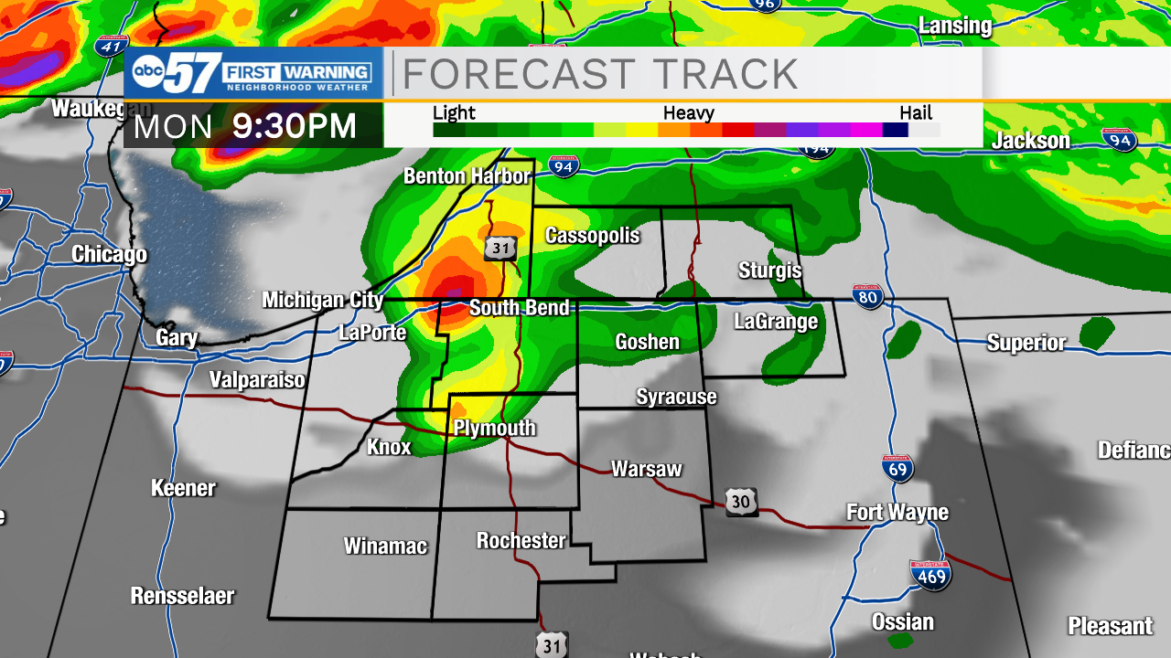 Storms start after 8 p.m.
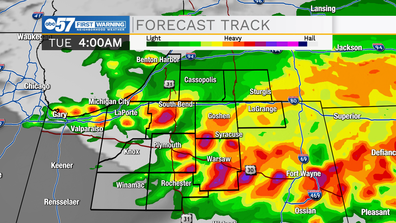
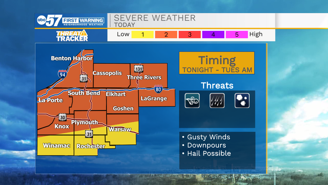
Storms continue overnight. There is a risk for some strong, possibly severe storms. Most likely impacts are downpours, gusty winds, and possibly hail.
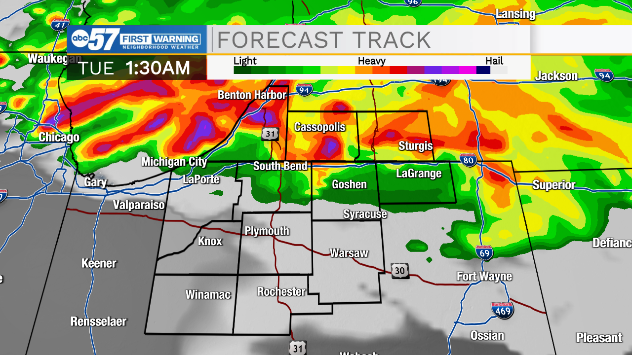
The outlook for severe weather has been slightly upgraded from earlier this morning. Parts of Michiana are at a level 2/5 threat (orange) for tonight.
The hot, humid conditions continue throughout most of the week.
There are additional rain and storm chances each day.
Luckily, it looks like we will dry out by Saturday and Sunday for next weekend’s plans.
Today: Mostly sunny and hot. PM storms. High 92.
Tonight: Thunderstorms. Low 72.
Tuesday: Scattered thunderstorms. Partly cloudy and hot. High 90.
Wednesday: Scattered thunderstorms. Partly cloudy. High 87.