Foggy start to Tuesday, active weather week

-
1:55

Temperatures going up along with our storm threat and wind gusts
-
1:48

Summer-like stretch ended by thunderstorms late Friday night
-
2:15

South Bend Police honors department members in 2024 awards ceremony
-
0:48

Women’s Impact Panel at Saint Mary’s College celebrates local...
-
3:07

Residents voice concerns over new sewer district
-
2:43

Fire crews spend hours working to put out flames at The Mill...
-
2:03

Head Coach of Washington High School Girl’s Basketball Team...
-
3:03

South Bend Walmart addresses parking lot potholes
-
0:39

Motorcyclist and passenger dead Wednesday afternoon after collision...
-
1:54

Very warm end to the week with storms and wind ahead
-
3:15

One currently hospitalized after reported explosion at Lock...
-
1:10

St. Joseph County Sheriff files motion to dismiss lawsuit brought...

Gloomy, with fog developing overnight, low visibility and temperatures near freezing, slick spots are possible on bridges and overpasses.
This week will be active but milder with highs closer to 50 most of this week. Tuesday is sunny, Wednesday is rainy and Thursday is sunny once again. The main focus will be on a power storm system this coming weekend. Strong wind may be the greatest threat, this is separate from any shower/storms that could produce higher gusts. Colder air return Sunday with a chance of snow.
Tonight: Mostly to partly cloudy, morning fog, low 32. 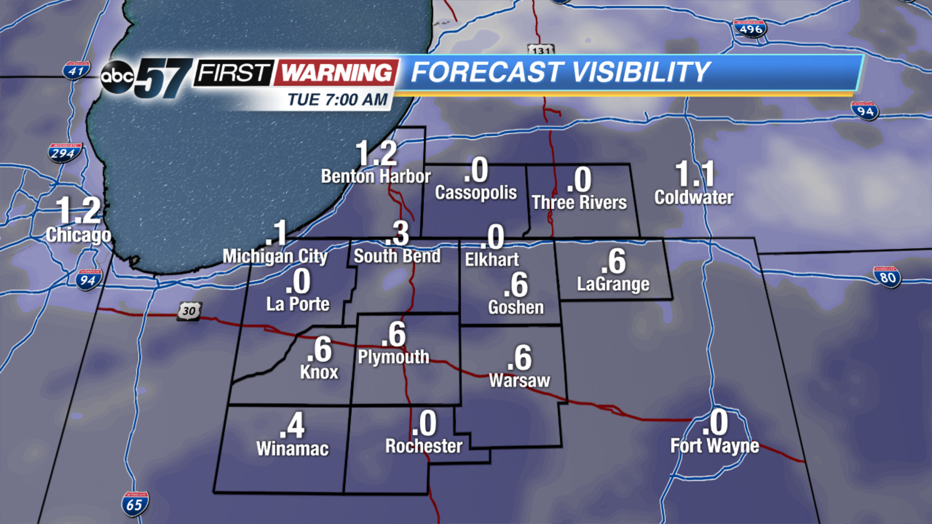 Forecast visibility Tuesday morning. The more clouds break, the more likely there could be dense fog.
Tuesday: Mostly sunny, high of 48.
Wednesday: Rain likely, high of 50.
Thursday: Mostly sunny, highs in the mid-40s. 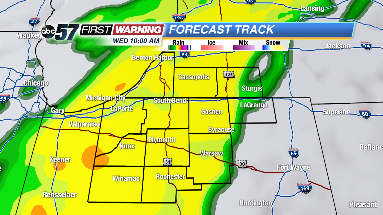 Swath of rain Wednesday could be moderate to heavy.