"Bomb cyclone" headed our way, and here's what it means


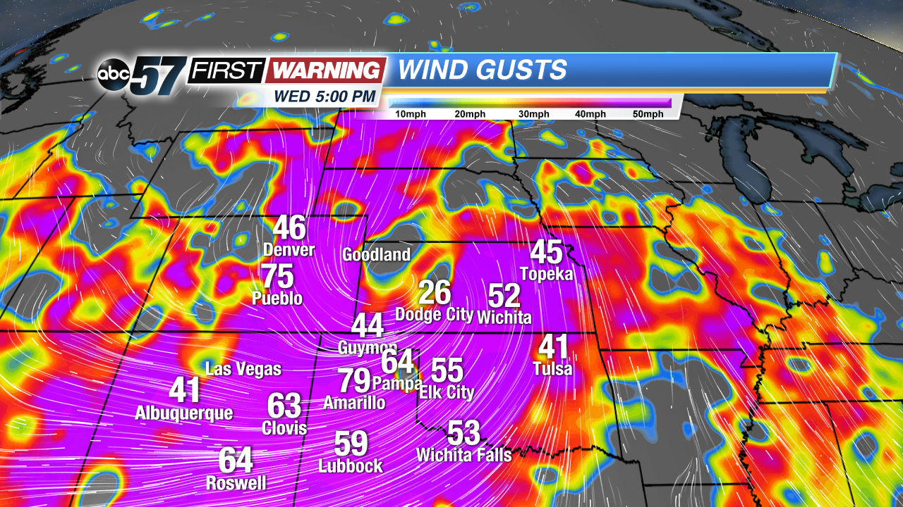
The next major winter storm is whipping through the central U.S. with blizzard conditions in six states. Colorado was hit hard on Wednesday. 73% of flights were cancelled at Denver International Airport, where winds peaked at 80 mph. It was not just Denver. The highest wind gust was at Colorado Springs airport of a whopping 97 mph.
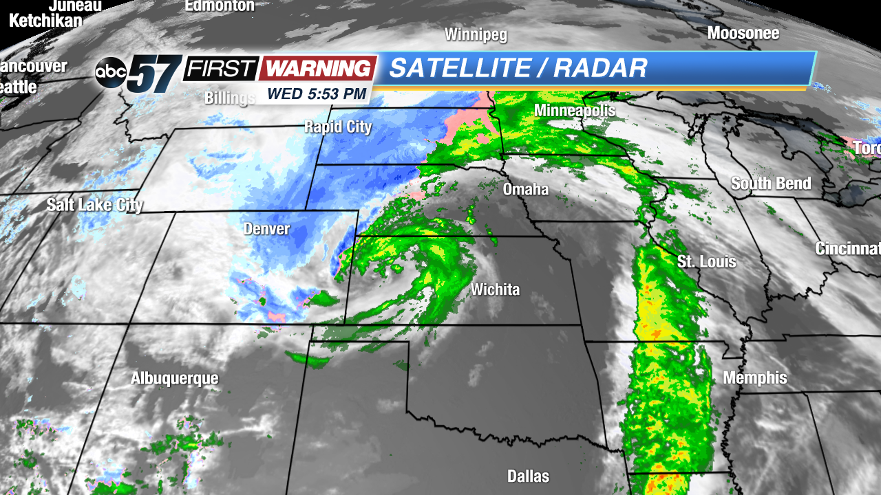
The system is wrapped tightly, with blizzard conditions on the top left side of the low pressure center, and warm air and rain on the right side of the low. Notice how it has a similar shape to a hurricane; well it actually had comparable pressure to a Category 2 hurricane on Wednesday.
The pressure was down to 968 millibars on Wednesday evening, which is very low, and the lower the pressure, the stronger the winds are in the system. All of these white lines show the mean sea level pressure gradient. The more lines there are and the closer they are together, the stronger the winds are.
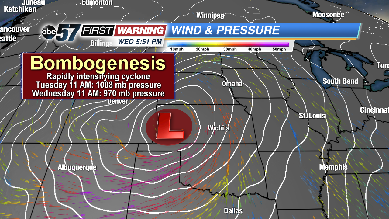
This system is officially a bomb cyclone, which is a term to describe a system that undergoes bombogenesis or rapid intensification. A system is said to rapidly intensify if the pressure drops 24 mb in 24 hours. In this case, the pressure dropped as much as 38 mb in 24 hours, from Tuesday morning through Wednesday morning.
The system will start to weaken Wednesday night into Thursday, and therefore the wind will start to weaken, but it will still be significant. There is a wind advisory in effect for all of Michiana on Thursday because winds gusts will be between 45 and 55 mph throughout the day, in addition to thunderstorms which are possible in the afternoon.