Another storm threat Saturday, then days of sunshine
Posted: May 31, 2019 4:50 PM EST

-
3:35

New house bills could reorganize local school corporations
-
3:51

Local Police Departments concerned over House Bill 1186
-
2:55

’Save Lakeside Woods’ successfully buys land back from developer,...
-
3:26

SBCSC announces community partnership to improve school literacy
-
2:21

Freezing rain reaches Michiana Wednesday night
-
2:25

Potential ice jamming in New Buffalo
-
2:31

The History Museum’s ’Worker’s Home’ brings 1950s African...
-
1:39

Cloudy and cooling down today with a wintry mix tomorrow
-
0:52

Mishawaka High School holds signing day for student athletes
-
2:47

Local Latin markets concerned about possible tariffs
-
0:30

Main building of Elkhart Clinic closed temporarily
-
3:02

RV Industry braces for possible tariffs

Clouds return Saturday, building along with the chance of showers and storms through the afternoon as a cold front sweeps the area. A line of storms is likely, some could be strong / severe with straight line wind being the greatest threat. Sunday is much cooler, highs in the 60s but sunny. Our first three-day stretch of dry weather since January lasts through Tuesday.
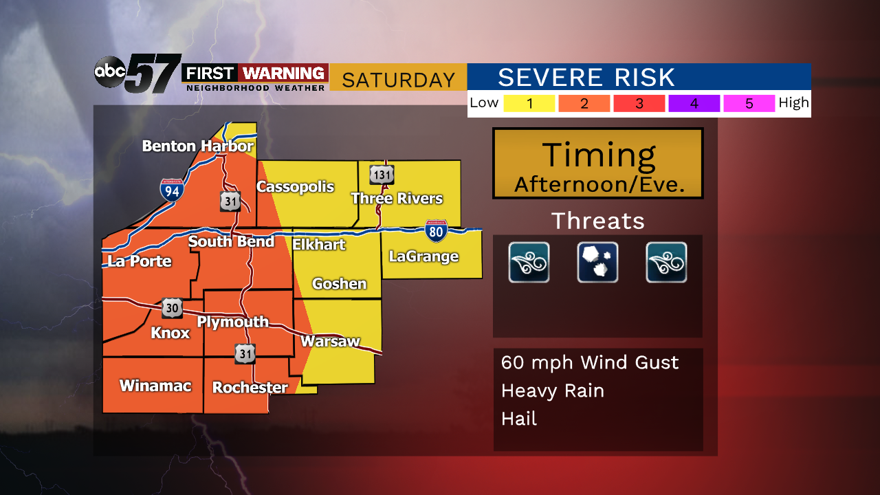
Tonight: A little muggy, fair, low of 64.
Saturday: Scattered showers and thunderstorms in the afternoon/evening. High of 78.
Sunday: Mostly sunny, high of 65.
Monday: Sunny, high of 68.
Tuesday: Mostly sunny, high of 74.
Sign up for the ABC 57Newsletter