Windy Wednesday, then falling temperatures and lake effect snow

-
1:52

Loveway hosting a volunteer interest session to help kids with...
-
1:41

More snow this morning, but a brief break heading into Wednesday
-
0:28

Niles Township Marijuana Establishments Ordinance tabled
-
2:40

SBCSC proposes closing Coquillard Elementary for St. Joseph County...
-
3:10

Road crews and street departments prepare for incoming snow
-
2:05

Lake effect snow ramps-up overnight
-
3:08

The snow is here
-
2:10

Local splash artist uplifts the community while helping local...
-
1:18

Vehicle rolls over into water-filled ravine, deputies report...
-
0:21

Holiday lights bring animal shaped fun to Potawatomi Zoo
-
1:02

Wellfield Botanic Gardens holds wreath making class
-
2:21

Heavy lake effect snow develops on Monday

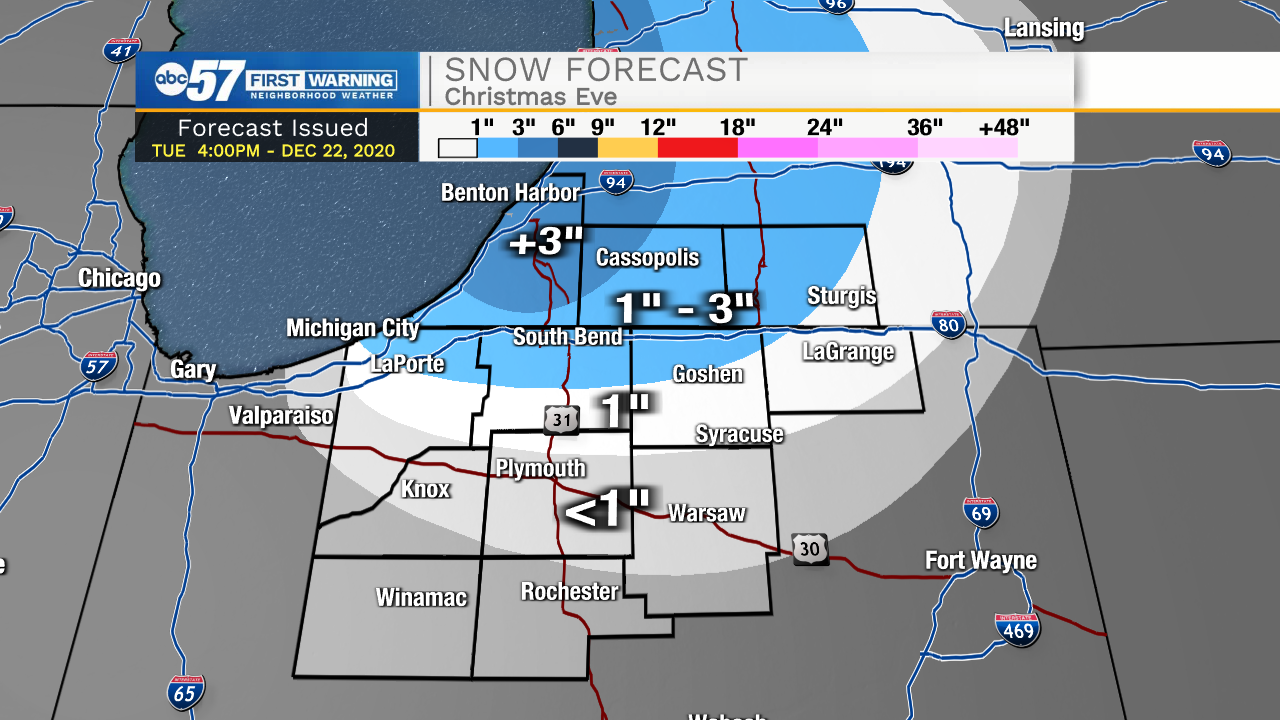
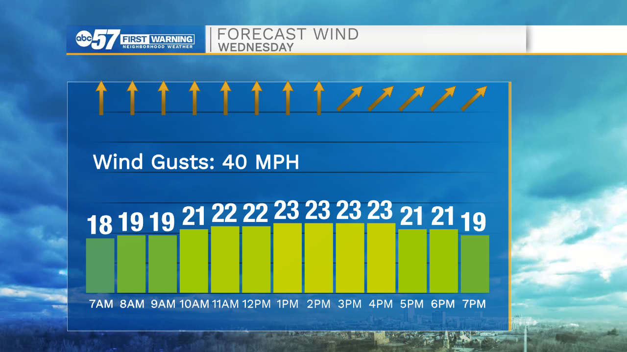
Wednesday is a mild and windy day, temperatures spike into the low 50s and the wind gusts up to 40 mph. Rain is likely Wednesday evening just before temperatures crash into Thursday. Little snow is expected from this system, as temperatures fall after most the precipitation has passed. Thursday is just a cold day, with temperatures falling into the teens by the evening. The setup for lake effect is Christmas Eve into the early morning. The snow window is relatively short and the wind setup is not the most favorable. Lake effect snow accumulation is most likely in extreme Northern Indiana and in Southwest Michigan. Up to three inches is the most likely amount in the snow belt. Christmas is cold but temperatures rise above freezing this weekend.
Tonight: Mostly cloudy. Low 36.
Wednesday: Mostly cloudy, windy, evening rain. High 52.
Thursday: Cold. Lake effect begins in the evening High 24.
Christmas Day: Morning snow showers. Cold. High 22.