Why is Michiana staying mostly dry? Blame Sally and the western wildfires


You may have heard this forecast before: a strong cold front is on the way to Michiana. Usually, we expect a cool down, breezy conditions, and rain showers and thunderstorms.
This time around, while those first two cold front consequences are expected, the last one is absent from the forecast.
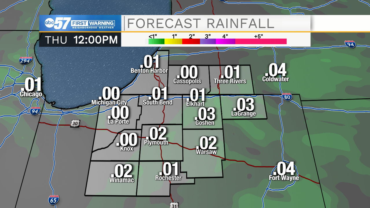
While a few showers are possible Wednesday night across Michiana, rainfall amounts should stay below a tenth of an inch for most spots.
Before you get mad at the meteorologists at ABC57 for another rainfall miss, might I offer you two scapegoats for the dry forecast: Hurricane Sally and the western wildfires.
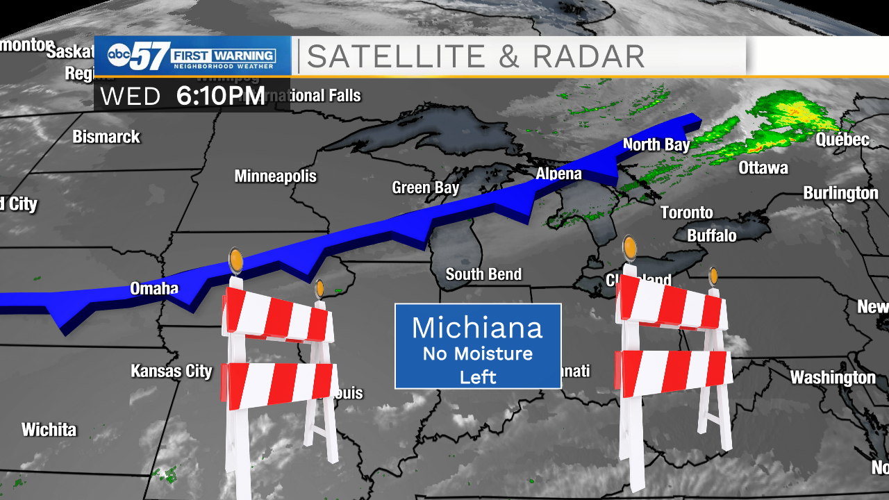
We'll start with Sally's role. One of the major sources of moisture for Michiana is the Gulf of Mexico. Southerly winds usually bring up humid air from the Gulf and set the area up for eventual rain and possible thunderstorms. But, Hurricane Sally has been stalled in the Gulf for a few days, taking most of the Gulf moisture with it.
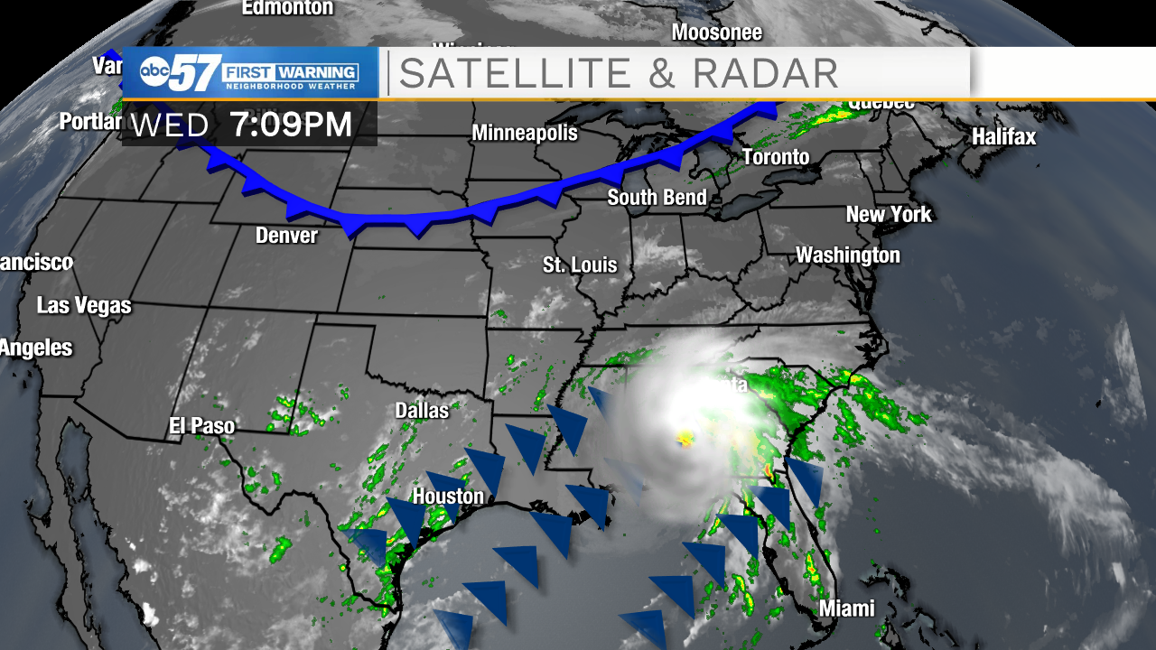
And the front will arrive in Michiana before Sally clears, meaning that there will be little humidity left for our cold front to use for rain showers.
While Sally is taking all of our humidity, the western wildfires could affect any showers that do manage to develop.
It's worth noting that smoke is actually not such a bad thing when it comes to rain chances developing. All clouds need a certain amount of smoke, dust, or other aerosols to get started (the technical term for these are cloud condensation nuclei, or CCN). Water vapor attaches to these CCN, forming clouds. However, if there is too much smoke in the atmosphere (like from the wildfires), it can stunt cloud development and can delay or sometimes stop precipitation from forming.
Because of this national double whammy, significant rainfall is not expected across Michiana this time around.