Storms clearing, cooler and calmer Thursday

-
1:26

Wet, warm & windy this weekend
-
4:24

Michiana Crime Stoppers shredding event
-
1:16

’IvyCares’ program setting students up for success in and...
-
1:45

Windy and wet this weekend, but unseasonable warmth as well
-
3:13

Local players react to $3 million investment in Byer Softball...
-
0:32

Layoffs at Whirlpool could affect workers in Benton Harbor
-
1:03

Annual District Sisterhood Conference at Ivy Tech empowers students
-
1:49

Back home in downtown South Bend, YMCA to open new location
-
2:16

This week’s ABC57 Cub Reporter is Nicholas Zentz
-
3:05

Amazon Web Services invests $11 billion to build data center...
-
4:05

Riley High School student center stage at the NFL Draft
-
1:35

Rain, wind, and milder temperatures forecast this weekend

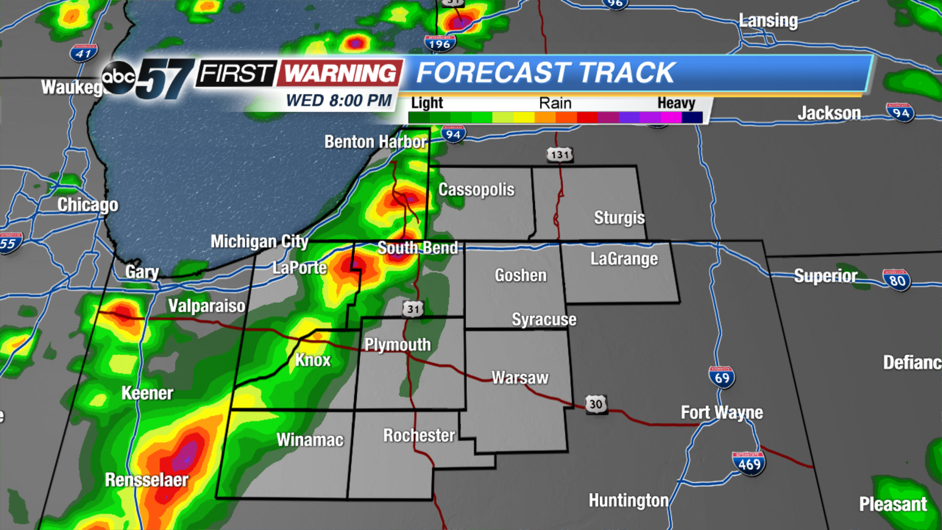
Update: Storms clearing Michiana through the 10:00 p.m hour, a few showers may linger into the early morning.
Storm threat through 10:00 p.m. Wednesday evening. Severe weather is possible, the greatest concern being strong wind gusts topping 60 mph and heavy rain. Storms develop west of Michiana around 5:00 p.m. and are likely to strengthen as they move east.
Thursday starts dreary with a few showers, clouds break by the afternoon. The pattern stays active with more showers and storms in the forecast Friday and Saturday. Saturday could be another severe weather threat. The forecast has changed greatly for Saturday as Michiana may hinge just north of a warm front that will split Indiana between the 60s and 70s in the north and 80s to the south.
Tonight: Evening thunderstorms, low 58.
Thursday: Morning showers then partly cloudy, high of 68.
Friday: Mostly cloudy, chance of showers and storms, high of 70.
Saturday: Scattered thunderstorms, high of 74.