
-
0:28

Elkhart General Hospital welcomes its first baby of the new year
-
2:02

Snow tonight, sub-freezing temperatures through next week
-
1:38

Remembering New Orleans terror attack victims
-
2:28

Travelers navigate hotel and flight changes following the New...
-
3:27

ABC57 speaks with Louisiana Attorney General Liz Merrill following...
-
6:49

ABC57 speaks with Bourbon St. business owner on the aftermath...
-
1:42

Snow showers end tonight, start up again late Thursday
-
1:50

Walking into 2025 with wintry weather on the way
-
2:28

Notre Dame and Georgia fans flood the streets of New Orleans
-
2:37

Coaches shake hands as they prepare to faceoff New Year’s Day...
-
2:13

South Bend skyline lights up for New Years Eve
-
2:44

New child labor law goes into effect January 1

Warm and very humid weather will be the forecast the rest of the week. The head index will be 90 or above each afternoon with dewpoints in the 70s. This will likely be the muggiest air so far this season. The extreme mugginess will fuel the day-night cycle of thunderstorms. Storms could once again produce heavy downpours along with the possibility of flooding. The patter does not break until next week.
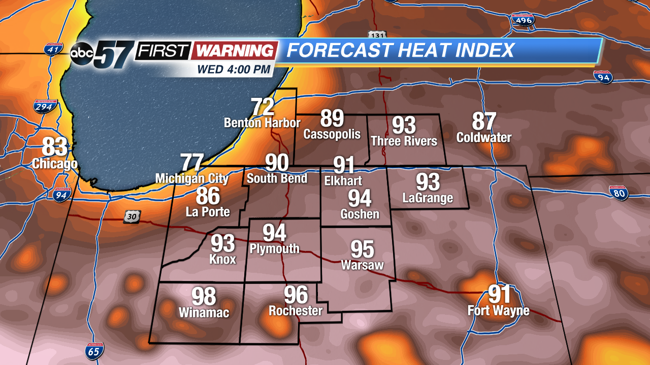 Heat index Wednesday afternoon well into the 90s for most the area.
Tonight: Mostly to partly cloudy, low 66.
Wednesday: Partly cloudy, high 87, isolated showers/storms.
Thursday: Very humid, partly cloudy, afternoon thunderstorms, high 90.
Friday: Very humid, partly cloudy, afternoon thunderstorms, high 88.
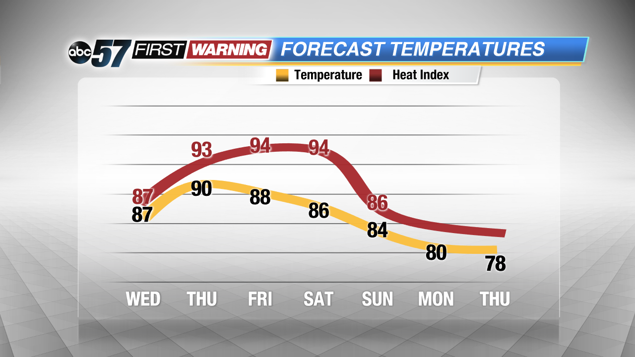 Extremely steamy through the weekend, no relief until early next week.
Sign up for the ABC 57Newsletter