The warm-up continues, chance of storms later this week
By:
Tom Coomes
Posted: May 14, 2019 4:47 PM EDT

-
0:46

Crowds gather for Fins and Feathers Fest at La Porte City Fairgrounds
-
0:46

Paramount School of Excellence hosts teacher fair
-
2:30

Voting advocacy, peaceful demonstrations and donations: South...
-
2:04

Warming to start the week, Showers and storms by Tuesday
-
2:10

Cool, but calm, today
-
1:23

City of South Bend presents an ’Age-Friendly Plan’ to better...
-
0:54

South Bend Venues Parks and Arts hosts ’Adult Recess’
-
2:27

Why Aneyas Williams turned down the transfer portal and stayed...
-
2:21

Bourbon community rallies around Triton boys’ basketball team...
-
5:02

Dave Matthews shares details about LLC bankruptcy filings
-
1:00

Warming up this weekend before more storms next week
-
1:46

A chilly and calm start to the weekend

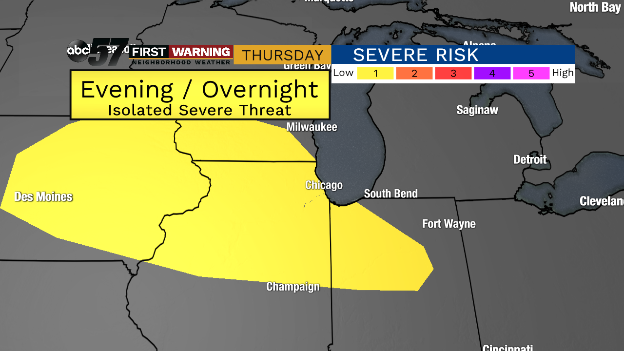
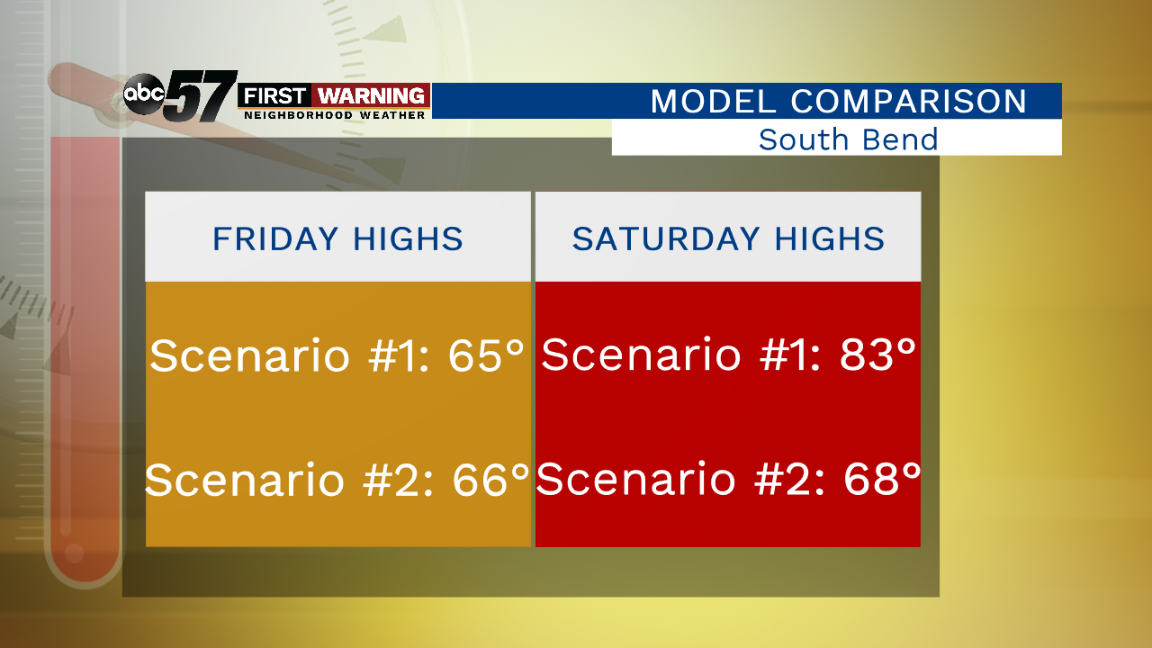
Clouds increase Wednesday but the rain chance remains low. Temperatures rise Thursday and some mugginess will fuel thunderstorms Thursday night. Michiana will be very close to a wavering front this weekend with warm air on one side and milder air on the other. Temperatures look to dip Friday the surge back towards 80 on Saturday. A small change in the position of the front could shift temps up or down significantly. The overall trend though is much milder, 70s and possibly 80s.
Tonight: Mostly to partly clear, low of 48.
Wednesday: Partly cloudy, isolated shower, high of 68.
Thursday: Partly cloudy, high of 76, chance of storms late.
Friday: Partly cloudy, chance of rain early, high of 68.
Sign up for the ABC 57 Newsletter