
-
4:37

Morris Performing Arts Center show season starts tonight
-
2:49

High Wind Warning today
-
1:08

Elkhart residents fight unauthorized mobile home
-
2:40

Fairfield breaks ground on $7 million athletics and band facilities...
-
0:50

Driver identified in single-vehicle crash on S.R. 933
-
0:42

Dan Schaetzle approved for 2026 re-election
-
1:02

YWCA receives donation to support women’s economic advancement
-
1:02

Local high schoolers learn about construction during Building...
-
3:38

Michigan synagogue attack hits home for ABC57’s Leo Goldman
-
1:29

What’s leading to higher gas prices right now
-
2:06

EF-2 tornado leaves half mile path of damage
-
2:49

St. Joseph County property assessments will see four percent...

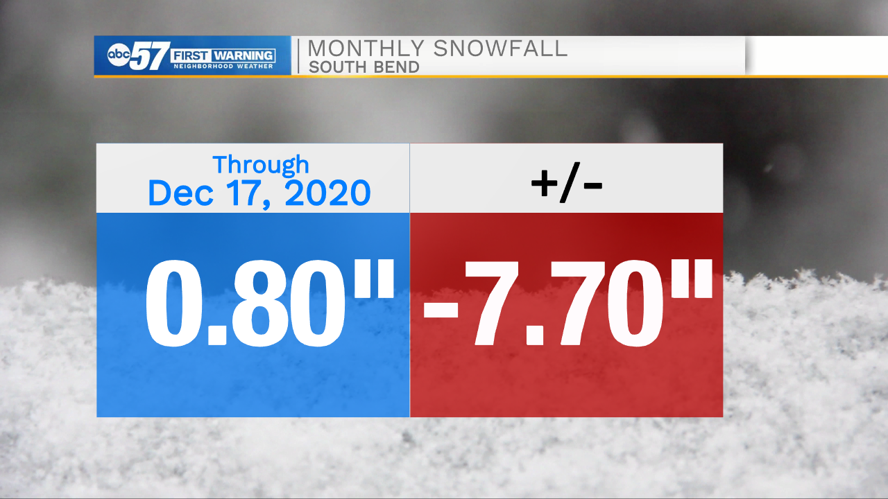
The gloomy weather continues, Friday morning is our best chance to see a little sunshine before clouds fill-in again by the afternoon. Saturday is the next round of wintry weather. Models are split slightly on timing, but the greatest consensus has precipitation starting in the afternoon and lasting through the evening. That scenario would mean rain, mix then some snow, with little accumulation. An earlier arrival would not change the end result much, precipitation could as snow then change to rain before switching back to snow. Next week is milder with highs in the 40s before a cold blast Christmas Eve that could bring some lake effect snow showers.
Tonight: Mostly to partly cloudy. Low 24.
Friday: Partly cloudy. High 36.
Saturday: Rain/snow showers. High 40.
Sunday: Mostly cloudy. High 38.