Strong winds, Lake effect snow, and cold temperatures

-
2:18

Expecting widespread winter weather impacts to tonight’s evening...
-
4:47

South Bend gears up for this years Polar Plunge Fundraiser
-
2:00

Winter weather advisory in effect later today; unpleasant evening...
-
3:13

Water service line replacements and infrastructure improvements...
-
3:37

Local farms ‘losing sleep’ over bird flu concerns
-
2:59

Indiana School Board races could become partisan
-
2:33

A burst of snow Wednesday evening
-
0:25

Multiple departments respond to Benton Harbor house fire
-
1:50

Beyond the Kitchen collaborates with other local non-profits...
-
1:43

Uneventful Tuesday gives way to a potential winter storm Wednesday
-
2:40

Penn-Harris-Madison trustee Matt Chaffee reads personal statement...
-
2:06

Baugo Township still embroiled in financial questions

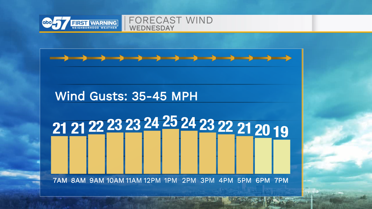
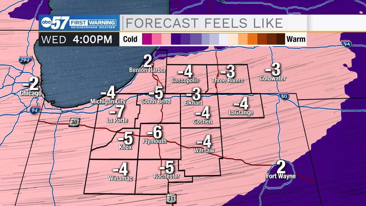
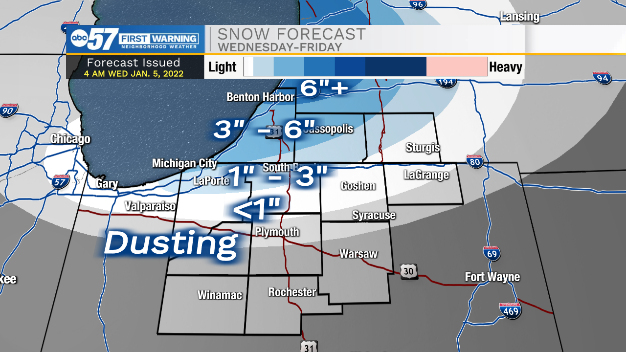
Winds will steadily increase through mid-morning as a cold front moves into Michiana. This cold front will shift winds out of the west bringing lake effect snow into southwest Michigan and portions of north central Indiana. Along with the snow and strong winds, temperatures will plummet throughout the day. Wind chills this evening will drop below 0 for most places throughout Michiana. Wind gusts today will range from 30-40mph. Lake effect snow will stick around through today, tonight, tomorrow, and Friday morning. Portions of Berrien and Cass counties could see close to half a foot off snow from now till Friday morning. A few inches of snow could push further south into Laporte and St. Joseph counties. Temperatures tomorrow will only warm into the upper teens and lower 20s. We will see temperatures rebound into the weekend where highs will finally break into the mid 30s.
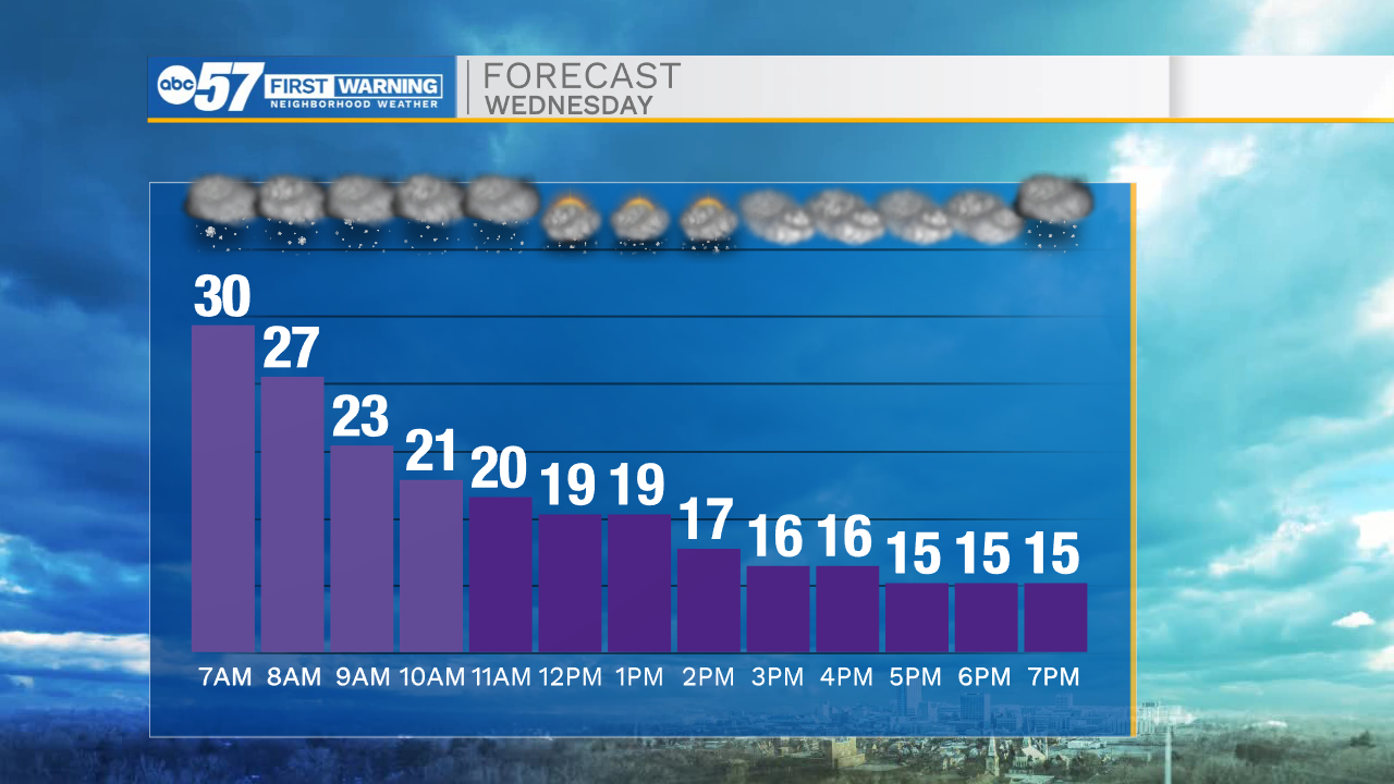
Today: Lake effect snow north/strong winds/cold temperatures. High 32.
Tonight: Lake effect snow north/strong winds/cold temperatures. Low 12.
Tomorrow: Lake effect snow north/breezy winds/cold temperatures. High 20.
Friday: AM Lake effect snow north. High 18.