
-
2:00

Notre Dame women’s basketball now hold 14-0 record over Wake...
-
2:42

Free summer camp aims to prepare Elkhart County kids for kindergarten...
-
1:07

Solutions discussed for dangerous section of US-31
-
1:58

Chicago Bears weighing move to Hammond
-
2:50

The prevalence of paid plasma donation centers
-
3:34

ABC57 News looks into resident complaints of a “blackout“...
-
6:20

Storage Sticker Shock: How A.I. Data centers are driving up the...
-
1:27

More storms possible this evening, snowy and windy Friday
-
1:44

Warm and quiet today, stormy tonight
-
4:06

Residents of St. Joseph County share concerns during Data Center...
-
1:09

Indiana State Treasurer visits South Bend
-
1:54

Local churches gather for annual Supermarket Sweep donation event

A round of light snow, possibly mixed with drizzle, will move through Michiana Saturday morning. Impacts will be minor, with most areas picking up less than an inch of snow, which will mainly fall on grassy surfaces. We’re still expecting a sudden warm-up with sunshine and spring-like temperatures Sunday and Monday. With highs nearing 50, we’ll be flirting with all-time record warmth. Rain develops across the area Monday night ahead of our next round of rain and snow Tuesday, Wednesday and possibly Thursday.
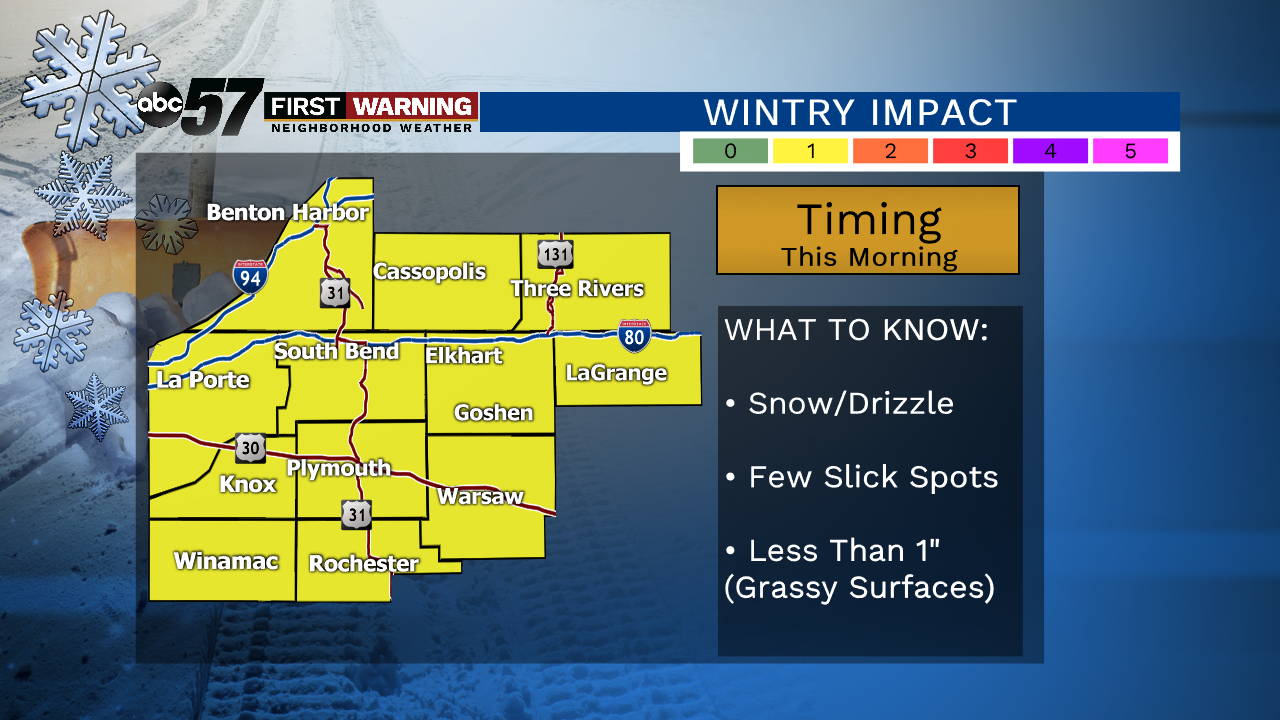
Today: Light snow/drizzle in the morning, then cloudy. High 38.
Tonight: Cloudy. Low: 32
Sunday: Mostly sunny and breezy. High 50.
Monday: Mostly cloudy. Rain develops at night. High 47.
Sign up for the ABC 57 Newsletter