
-
3:14

Plans for a functional ambulance in talks in Union Township
-
3:08

St. Joe County Council votes to amend council rules
-
3:32

Dog finds new life after being saved from troubled Kosciusko...
-
0:54

Elkhart Clinic main campus set to reopen after gasoline vapor...
-
3:56

Reflecting on the COVID-19 global pandemic, five years later
-
0:34

Tickets for WNBA pre-season matchup at Purcell Pavillion go on...
-
1:16

Warming up this week with a windy weekend ahead
-
0:38

South Bend Washington’s Coach Reynolds resigns, will explore...
-
3:38

Andrews University buries time capsule for 2075
-
0:25

Berrien County Sheriff’s Office K9s receive body armor donation
-
2:23

National Weather Service cutting back on weather balloon launches
-
2:47

Juday Creek Golf Course plans to rise from the ashes as they...

Update: Round three will bring another round of heavy rain after midnight, lightning and thunder. The severe threat remains low but flooded roads my persist into Tuesday morning.
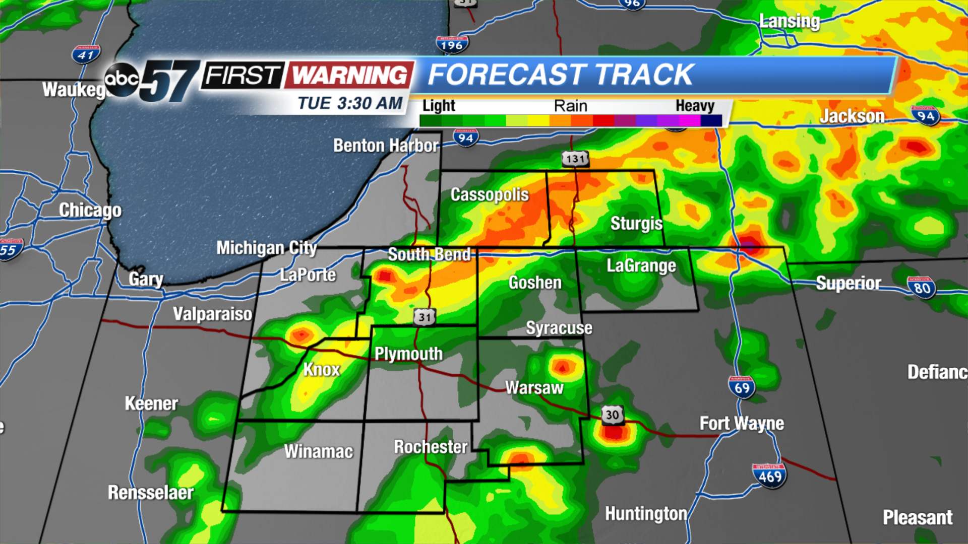
Another round of thunderstorms will roll through Michiana this evening. The window for possible severe weather and flooding will be between 7 PM and midnight. Threats include gusty wind, hail, lightning, heavy rain and flooding.
Showers start Tuesday, then clouds gradually break the rest of the day. A few much needed dry days return to the forecast midweek. Wednesday and Thursday will be drier and less humid with sunshine. The humidity build again to end the week along with the chance of showers and Thunderstorms.
Tonight: Thunderstorms are likely, showers linger into the morning, low 62.
Tuesday: Morning showers, gradually clearing, high 72.
Wednesday: Mostly sunny, highs in the mid-70s.
Thursday: Mostly sunny, highs in the mid-70s.