Roller coaster temperatures with week with no sign of true winter
By: Emily Kennedy
Posted: Jan 6, 2020 3:09 AM EDT

-
1:52

Snow today, rain tomorrow, and warm this weekend
-
0:49

Celebrating St. Patrick’s Day at Corby’s Irish Pub
-
1:58

The Free Market promotes sustainable shopping
-
3:27

Federal judge temporarily blocks RFK Jr.’s vaccine policy changes...
-
1:02

Chicory Cafe celebrates St. Patrick’s Day with corned beef...
-
2:43

City of Elkhart, EPA, IDEM prepare for removal of contaminated...
-
2:58

South Bend goes green for St. Paddy’s Day at Fiddler’s Hearth
-
2:23

St. Joseph County boards, City of Mishawaka, approve Memorandum...
-
2:40

More than just fighting fires: Warsaw fire official helps with...
-
1:38

Snow Wednesday, rain Thursday, mild Friday
-
2:11

Snow wrapping up today, returns tomorrow
-
4:39

The Morris debuts its 2026-27 season lineup

Monday, January 6th, 2020
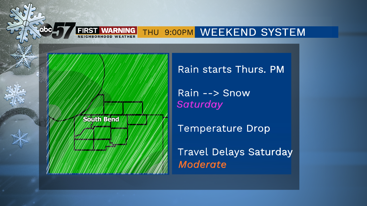
Plenty of sunshine today, making it a perfect day to take down the Christmas lights if you haven't yet. Clouds start to move back in tomorrow and as a week cold front moves through, we could briefly see snow/mix. That drops our daytime highs into the upper 20s for Wednesday with lake effect flurries possible in Michigan. We warm right back up Thursday into the mid 40s! Rain comes along with it late that evening and will last into Friday. Colder air start to move back in Saturday and that's when it could get messy as rain turns to snow.
Today: Mostly sunny. High of 43.
Tonight: Partly cloudy. Low of 28.
Tuesday: Mostly cloudy, slight chance of snow/mix. High of 38.
Wednesday: Partly to mostly cloudy. High of 28.
Sign up for the ABC 57 Newsletter