Rain chances linger through the next several days

-
2:52

McKinnies Realty expansion looks to spread word on Homes for...
-
1:19

Timing out the rain on Halloween
-
2:27

Elkhart County Historical Museum offers community ofrenda in...
-
1:57

Flowers Early Learning battles for childcare needs
-
1:41

A Summer-like stretch of weather ends on Thursday
-
3:04

Michigan voters showing up in droves to election polls
-
1:12

South Bend Common Council looking to annex a portion of the County
-
1:43

Pulaski County enters day 10 of burn bans
-
1:33

Warm and breezy end of to October
-
2:54

Drug overdoses continue to decrease across Michiana
-
1:44

How often is it to see 80 degrees after the first frost?
-
1:34

From just above average today to the 80s later this week

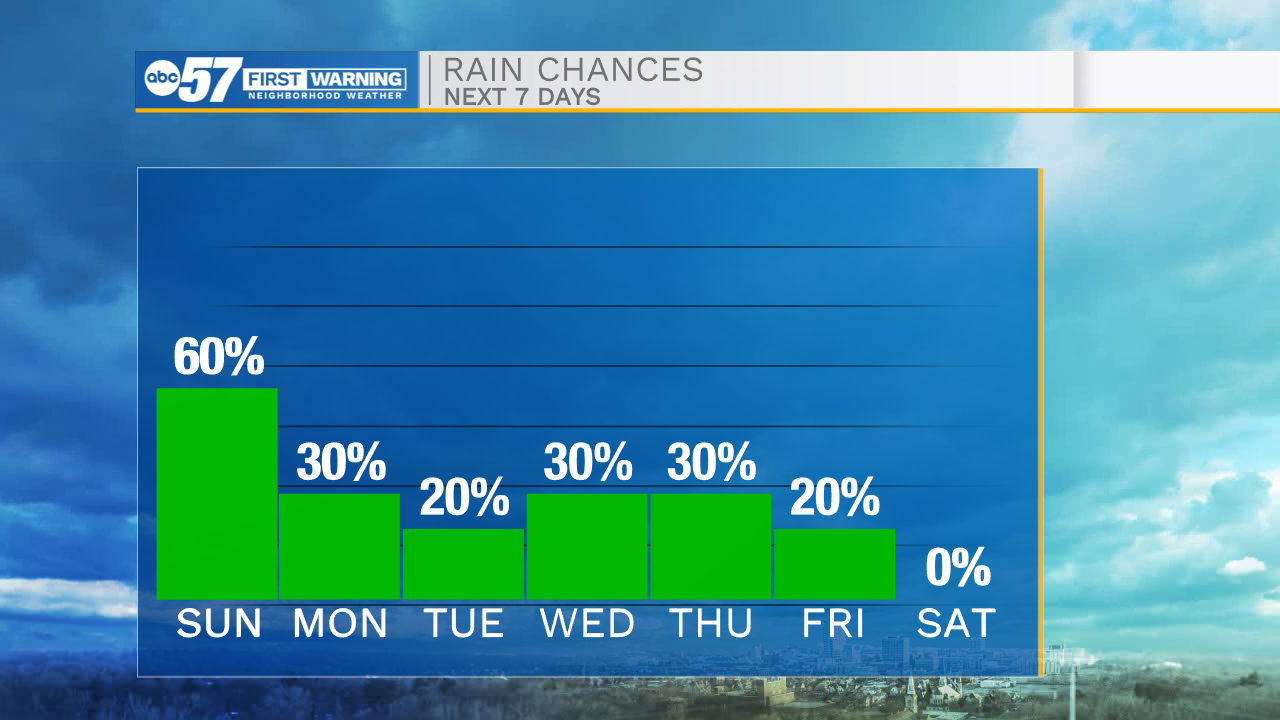
Scattered showers will remain off and on throughout the overnight hours. Low temperatures tomorrow morning will drop into the mid 60s. Sunday will be another rainy one for us across northern Indiana and southwest Michigan. Along with the rain cloud cover will remain in place, helping to keep high temperatures in the low to mid 70s. This system moving through the area will stall out to our east, allowing for more isolated to scattered showers to linger into Monday. It will finally clear into the middle part of the work week, but still isolated rain chances remain in the forecast. High temperatures throughout next week will top out in the mid 70s.
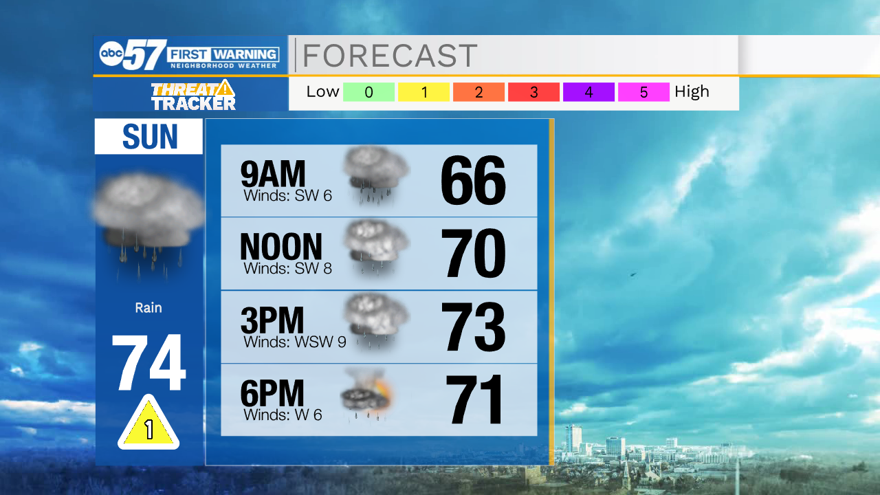
Tonight: Scattered showers. Low 65.
Tomorrow: Scattered showers. High 74.
Monday: Isolated showers. High 72.
Tuesday: Partly cloudy. High 74.