-
2:04

Warming to start the week, Showers and storms by Tuesday
-
2:10

Cool, but calm, today
-
1:23

City of South Bend presents an ’Age-Friendly Plan’ to better...
-
0:54

South Bend Venues Parks and Arts hosts ’Adult Recess’
-
2:27

Why Aneyas Williams turned down the transfer portal and stayed...
-
2:21

Bourbon community rallies around Triton boys’ basketball team...
-
5:02

Dave Matthews shares details about LLC bankruptcy filings
-
1:00

Warming up this weekend before more storms next week
-
1:46

A chilly and calm start to the weekend
-
1:00

NIPSCO workers rally in South Bend for new contract
-
1:53

Severe weather threat is over, MUCH colder Friday
-
3:43

South Bend Mayor James Mueller delivers 2026 State of the City...

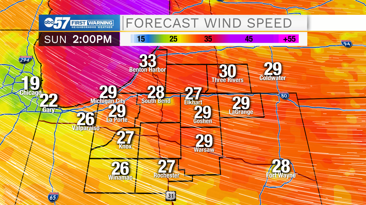
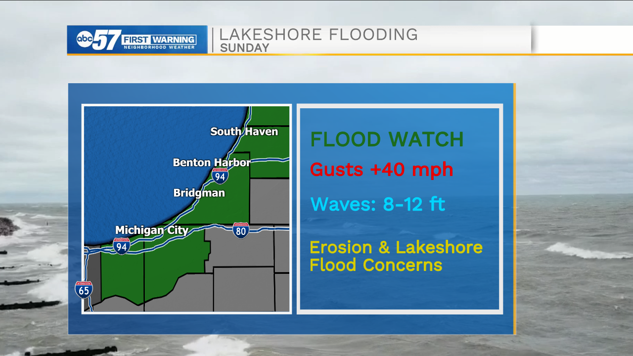
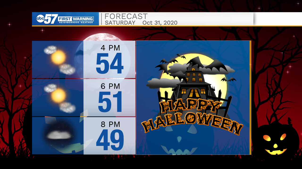
Halloween Saturday is nice and fair, through trick-or-treating, Sunday is a blustery mess with wintry mix possible. A strong cold front with cut through late Saturday night bringing rain. Temperatures fall from the low 40s early Sunday into the 30s by the afternoon. Wind gusts could reach 40 mph and waves on Lake Michigan could be up to 12 feet. The cold breeze across the lake could producer lake effect showers, with temperatures in the mid-30s these showers could be rain or snow. Accumulation is not expected. Next week is extremely mild for early November. The biggest question is could we hit 70 again?
Tonight: Clearing. Low 30.
Tomorrow: Mostly sunny. High 54.
Sunday: Blustery, falling temperatures, lake effect rain/snow showers. High 40.
Monday: Mostly sunny. High 48