Milder end of the week, focus turns to Monday's potential snow.
By:
Tom Coomes
Posted: Dec 11, 2019 6:26 PM EDT

-
0:40

Baxmeyer defends actions amid solar farm bond debate
-
2:11

Southwest Michigan Cares Fund reaches over $70k as families still...
-
1:35

Severe weather threat ending across Michiana
-
0:51

SJCPD responds to AG’s appeal of lawsuit dismissal
-
2:13

More strong storms likely this evening
-
2:15

The ingredients for severe weather
-
2:14

Why summer travel prices may spike due to the ongoing war in...
-
1:49

Heavy rain, high winds, and hail are main severe concerns today
-
1:26

Amidst several rounds of storms, some could be severe today
-
0:34

South Bend Community Review Board hosts open discussion on youth...
-
2:19

INDOT walks through a proposed diverging diamond intersection...
-
1:08

Notre Dame’s Leonard Moore highlights student success and raises...

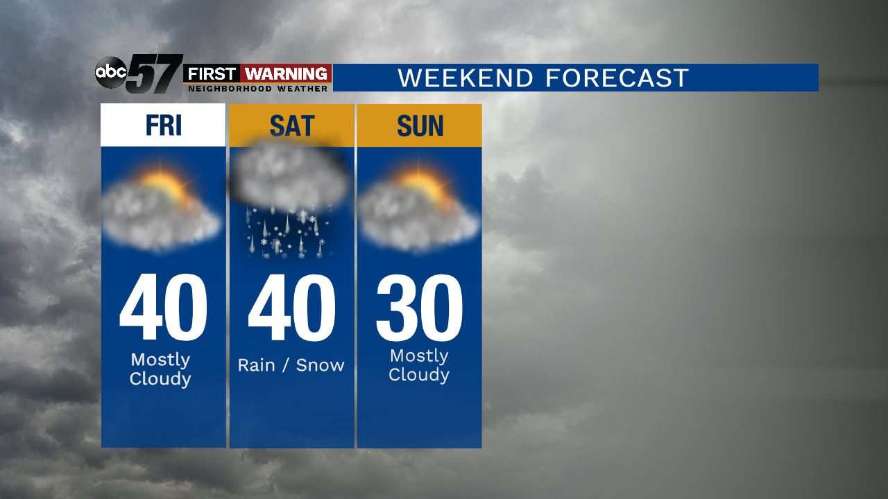
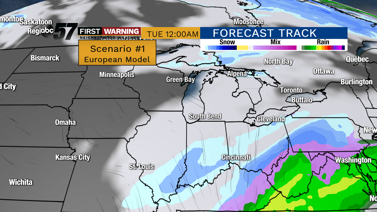
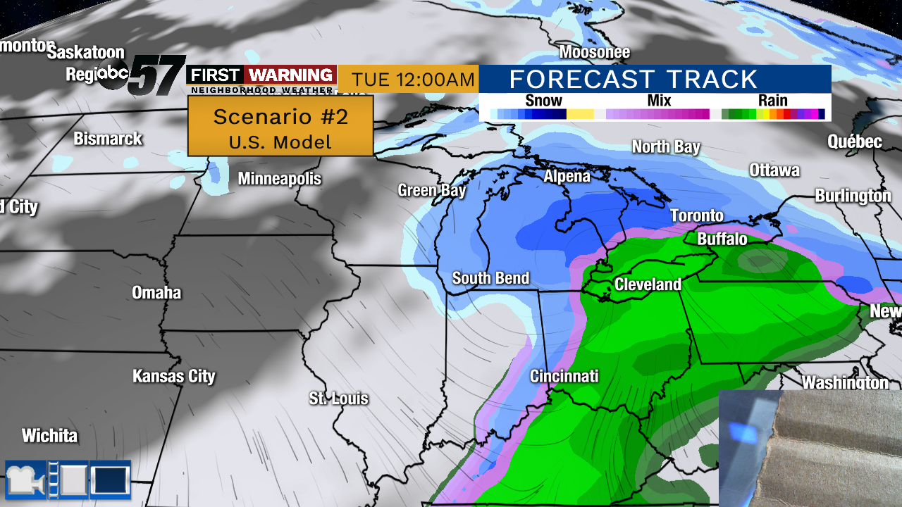
The weather moderates to end the week, mostly cloudy with highs near 40 and lows near the freezing mark. Michiana remains on the edge of any major weather with only a slight chance of rain/snow Saturday and temperatures cooling into Sunday. The main focus will be on Monday to see if we are grazed or take a more direct hit from a winter storm. There is still not a good model consensus.
Tonight: Partly cloudy. Low of 16.
Thursday: Increasing clouds. High of 40.
Friday: Mostly cloudy. High of 40.
Saturday: Cloudy, chance rain/snow. High of 40.
Sign up for the ABC 57 Newsletter