Messy system moves to end the week then bitter cold

-
0:46

Crowds gather for Fins and Feathers Fest at La Porte City Fairgrounds
-
0:46

Paramount School of Excellence hosts teacher fair
-
2:30

Voting advocacy, peaceful demonstrations and donations: South...
-
2:04

Warming to start the week, Showers and storms by Tuesday
-
2:10

Cool, but calm, today
-
1:23

City of South Bend presents an ’Age-Friendly Plan’ to better...
-
0:54

South Bend Venues Parks and Arts hosts ’Adult Recess’
-
2:27

Why Aneyas Williams turned down the transfer portal and stayed...
-
2:21

Bourbon community rallies around Triton boys’ basketball team...
-
5:02

Dave Matthews shares details about LLC bankruptcy filings
-
1:00

Warming up this weekend before more storms next week
-
1:46

A chilly and calm start to the weekend

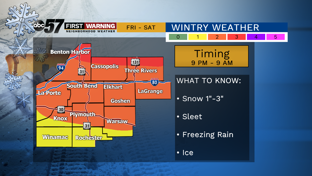
Thursday, January 16th, 2020
Sunshine today for some but lake effect clouds will keep our northern counties covered more often. While temperatures start in the 30s early in the morning, they will fall to the mid 20s by the afternoon.
The next system moves in late Friday, starting out at as snow but it turns to a freezing rain and sleet Saturday morning. As temperatures rise, the wintry mix will turn to rain, melting much of the snow and ice. The sharp drop in temperatures comes Sunday, behind the system. Lake effect snow will be possible with daytime highs only in the 20s.
Today: Mostly to partly cloudy, breezy. Temperature falls from 30.
Tonight: Few clouds. Low of 20.
Friday: Mostly cloudy, snow late. High of 30.
Saturday: Freezing rain early, then all rain. High of 40.