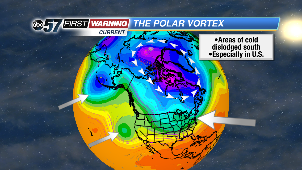
 Pieces of the Polar Vortex moved southward during November, sending cold into the U.S.
As you're probably well-aware, November was cold. Very cold. It was that way for nearly the entire United States, but the coldest of the air was centered in the Great Lakes and Midwest. It was also one of the snowiest Novembers on record for South Bend and other nearby cities like Chicago and Rockford, Illinois.
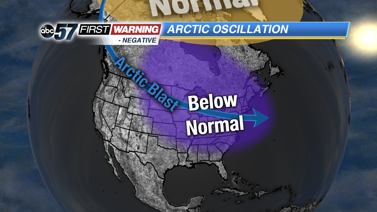 Typical Negative Arctic Oscillation pattern in the United States.
Why was this the case? Why was nearly the entirety of the Lower 48 below normal and more active than normal in November? That question can't be answered quickly as there are multiple variables that play a role in determining how warm or cold any given November is. But there are a few that play a bigger role than others. One of those is referred to as the
Arctic Oscillation.
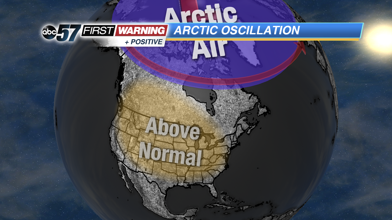 Typical Positive Arctic Oscillation pattern in the United States.
Now, what in the world is that? Per NOAA, "The AO [Arctic Oscillation] is a climate pattern characterized by winds circulating counterclockwise around the Arctic at around 55°N latitude." That may not really answer the question of what exactly it is, but what you need to know is that the AO can be positive, negative or neutral. And, depending on which of those three phases it's in, the Great Lakes region can see cold, snowy weather or mild, quiet weather. For November, the Arctic Oscillation was by-and-large in a
negative phase. That is not the sole reason why we saw snowy, cold weather here in Michiana, but it's certainly a big player in the overall equation. Looking ahead, things are set to change.
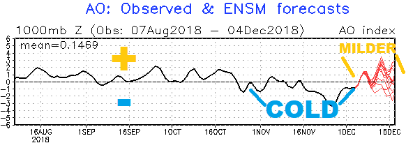 Arctic Oscillation heading toward a positive (+) phase. This means slightly milder air.
NOAA
Arctic Oscillation heading toward a positive (+) phase. This means slightly milder air.
NOAA
Most of our forecast models are pinpointing a shift toward a positive or near-neutral AO beginning around December 7th and lasting through at least the 20th, if not longer. As a result, we are expecting quiet and milder weather for upwards of 1-2 weeks beginning this Friday. It won't be mild as in 50s and 60s, but highs well into the upper 30s and 40s are likely. A few mid-40s can't even be ruled out by late next week. Even more, there's pretty much zero precipitation and quite a bit of sunshine in the forecast from the 7th thru the 12th.
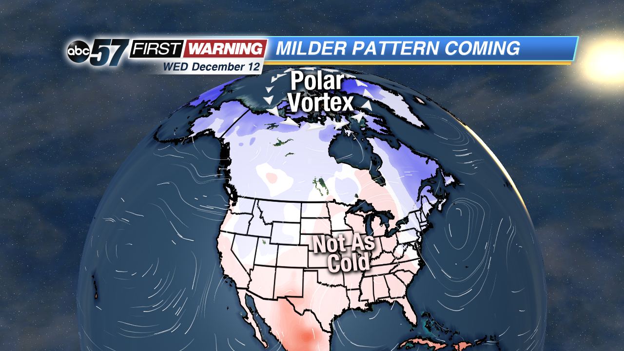 Forecast model's project of temperatures on December 12th.
It's important to remember that the Arctic Oscillation is only a part of the equation. Other climate-related variables like the North Atlantic Oscillation, Northern Hemispheric snow cover, the extent of Arctic ice, and others. However, it is with high confidence that we can say the period of roughly December 7th thru the 20th or so looks milder than November and quieter overall. Something to keep an eye on, though, is a potential storm system around December 15-16 that could bring heavy precipitation and strong winds. It's far too early to talk specifics, but it's something to keep in mind.


