Lake effect snow continues through Thursday
Posted: Jan 9, 2019 4:31 PM EDT

-
2:52

McKinnies Realty expansion looks to spread word on Homes for...
-
1:19

Timing out the rain on Halloween
-
2:27

Elkhart County Historical Museum offers community ofrenda in...
-
1:57

Flowers Early Learning battles for childcare needs
-
1:41

A Summer-like stretch of weather ends on Thursday
-
3:04

Michigan voters showing up in droves to election polls
-
1:12

South Bend Common Council looking to annex a portion of the County
-
1:43

Pulaski County enters day 10 of burn bans
-
1:33

Warm and breezy end of to October
-
2:54

Drug overdoses continue to decrease across Michiana
-
1:44

How often is it to see 80 degrees after the first frost?
-
1:34

From just above average today to the 80s later this week

Lake effect snow showers continue overnight through Thursday morning. An additional one to three inches are possible.
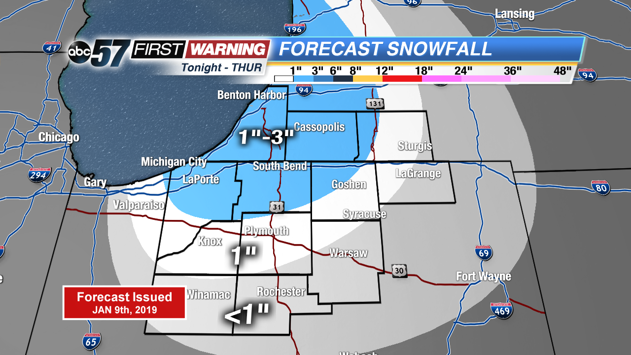
Lake effect snow showers will slow the morning drive again Thursday before waning during the day. Temperatures rise gradually in to the mid-20s, with a break from the snow that lasts through Friday. A storm system looks to bring widespread snow to the Midwest, with an increasing potential for at least three inches area wide Saturday. Stay tuned for updates as finer details come into focus.
Tonight: Lake effect snow, breezy. Low of 20.
Thursday: Morning snow showers, mostly to partly cloudy. High of 28.
Friday: Partly to mostly cloudy. High of 32.
Saturday: Snow showers, high of 32.
Sign up for the ABC 57Newsletter