
-
0:46

Crowds gather for Fins and Feathers Fest at La Porte City Fairgrounds
-
0:46

Paramount School of Excellence hosts teacher fair
-
2:30

Voting advocacy, peaceful demonstrations and donations: South...
-
2:04

Warming to start the week, Showers and storms by Tuesday
-
2:10

Cool, but calm, today
-
1:23

City of South Bend presents an ’Age-Friendly Plan’ to better...
-
0:54

South Bend Venues Parks and Arts hosts ’Adult Recess’
-
2:27

Why Aneyas Williams turned down the transfer portal and stayed...
-
2:21

Bourbon community rallies around Triton boys’ basketball team...
-
5:02

Dave Matthews shares details about LLC bankruptcy filings
-
1:00

Warming up this weekend before more storms next week
-
1:46

A chilly and calm start to the weekend

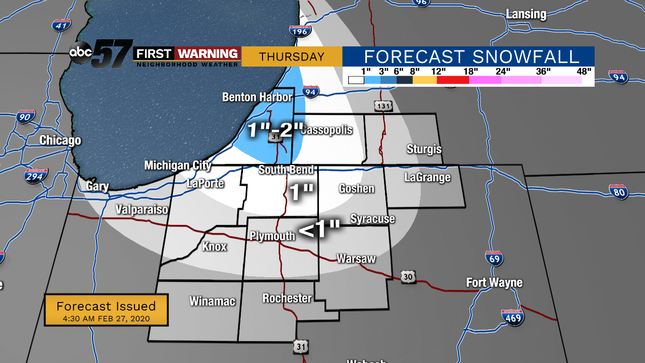
Thursday, February 27th, 2020
Lake effect snow showers are coming down this morning but will taper down later today. An additional 1-2” is possible for our Michigan counties but less than an inch is expected outside of that. A few flurries will hang on through Friday morning, otherwise it just stays cold and breezy.
Temperatures start to improve over the weekend with a lot more sunshine in store. Daytime highs climb into the 40s again by Sunday. It stays mild for the beginning of the work week but rain chance returns along with it.
Today: Lake effect snow showers and breezy. High 26.
Tonight: Flurries possible, mostly cloudy. Low 16.
Friday: AM flurries, then mostly to partly cloudy. High 25.
Saturday: Partly cloudy. High 30.
Sign up for the ABC 57 Newsletter