Isolated evening storms, otherwise drying out, hot and humid

-
2:15

Severe weather likely for portions of Michiana later today
-
2:34

Open House for a new pedestrian bridge leaves Riverside Residents...
-
2:16

Notre Dame’s CJ Carr embraces growing expectations while leading...
-
2:34

Injuries sideline key linebackers as Notre Dame leans on depth...
-
0:58

U.S. Army increases maximum enlistment age from 35 to 42
-
2:08

Large hail, damaging winds and tornadoes possible Thursday
-
1:40

Nicholas Stanley appears in court, prosecutors push to prevent...
-
3:18

Expert breaks down high gas prices and factors impacting price...
-
2:08

Westview community rallies around boys’ basketball team headed...
-
2:06

The threat for severe weather has increased
-
2:16

More sunshine today with a severe risk tomorrow
-
0:32

Granger residents share input on proposed S.R. 23 roundabout

ABC57 First Warning Neighborhood Weather
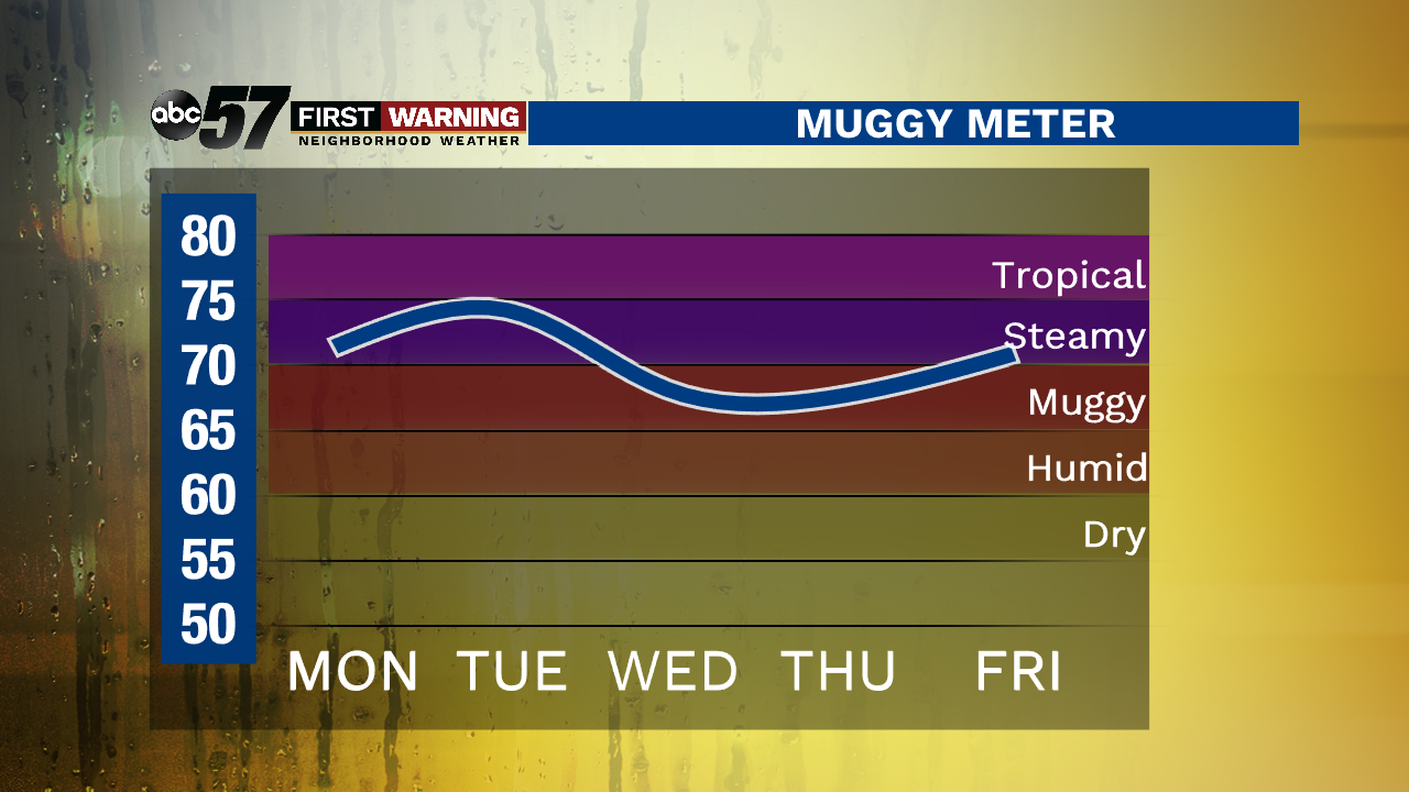
Monday, June 29th, 2020
This week is hot and humid. Daytime highs climb into the upper 80s the next two days and then into the low 90s through the holiday weekend. Make sure you’re drinking plenty of water and taking breaks from the heat. Today there is a chance of isolated storms this evening and overnight. A shower or storm may linger into Tuesday morning, otherwise the rest of the day is dry with clouds breaking up. The rest of the week is sunny and dry. Due to the lack of rain, take extra precautions when lighting off fireworks.
Today: Partly sunny. Evening thunderstorm possible. High 88.
Tonight: Isolated storm, mostly cloudy. Low 72.
Tuesday: Early morning t-storm possible then partly cloudy. High 88.
Wednesday: Mix of sun and clouds. High 90.