Increasing likelihood of named storm in Gulf of Mexico
It has been a quiet hurricane season thus far in the Atlantic, but that could certainly change in the next several days.
The National Hurricane Center has given a non-tropical area of low pressure located in the Tennessee Valley a 50% chance of developing in the northeastern Gulf of Mexico over the next five days. See the image above.
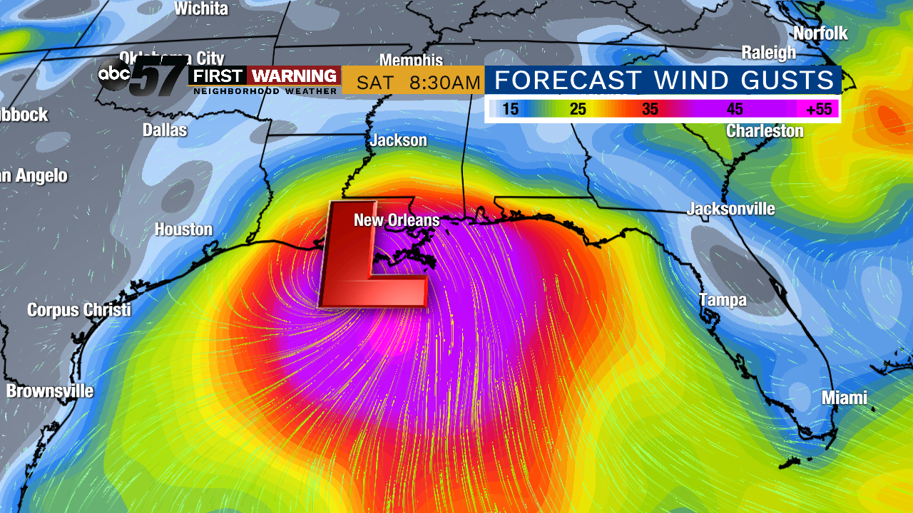 One forecast model's depiction of the tropical system by next Saturday morning. This would be a rather strong named storm, which is a possibility.
If the low moves out into the Gulf and remains there for a couple of days, there is an excellent chance of a tropical system (it would become Barry).
However, if the low barely moves off-shore, the chance of a named storm is lower.
At this point, all things continue to suggest a higher chance of a named storm by late this week. Impacts are possible from Houston, Texas, to Fort Myers, Florida, depending on the eventual path and growth of the system.
Those will range from heavy rain and flooding to storm surge and strong winds. Regardless of whether or not the system develops into a named storm, heavy rain and flooding are a concern for parts of the Gulf Coast.
