Hot and humid with isolated storm chances

-
1:56

Quiet morning, Severe storms likely this afternoon
-
2:52

Berrien County Parks updated ordinance in effect
-
1:52

Singing Sands Festival is in full swing, welcoming master sand...
-
2:32

Staying weather aware at the Elkhart 4H Fair
-
2:48

SBCSC nears pre-pandemic ILEARN scores; still trailing state...
-
1:28

Youth sports taking center stage in South Bend
-
1:22

Two men facing charges in the June 7 murder of Kristina Ortiz
-
0:46

Annual Folds of Honor Charity Classic golf outing Friday
-
2:07

Severe storms possible Saturday
-
1:26

Duck, Duck, Go! Duck races at the Elkhart County 4-H Fair
-
4:12

Premier Arts debuts all-youth ’The Little Mermaid’
-
1:26

Rockin’ the 4-H Exhibit

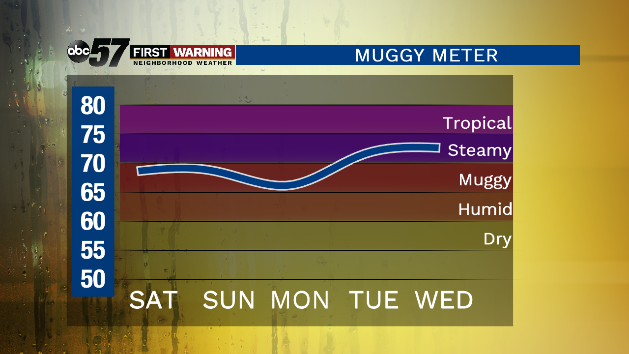
A mix of sun and clouds through much of the day with temperatures soaring into the upper 80s. Isolated storms are possible late this evening with a few more storms possible overnight. A couple of storms could be strong. The hot and humid weather continues over the weekend with daytime highs climbing near 90 degrees and heat indices into the mid to upper 90s! Make sure you’re drinking plenty of water.
We stay very warm heading into next week with a few more storms possible the middle of next week.
Today: Mostly to partly sunny, shower/storm possible, high of 89.
Tonight: Partly cloudy, shower/storm possible, low of 71.
Saturday: Partly cloudy with an isolated storm possible, high of 88.
Sunday: Mostly to partly sunny with isolated storm possible, high of 90.