


Northern Indiana and southwestern Michigan have been absolutely waterlogged since 2016.
The last four years have been historically wet across Michiana and rank in the top 20 wettest years in South Bend recorded history.
And, throughout much of this year, it looked like Michiana would continue this very wet trend.
Then this autumn arrived. And the rain stopped.
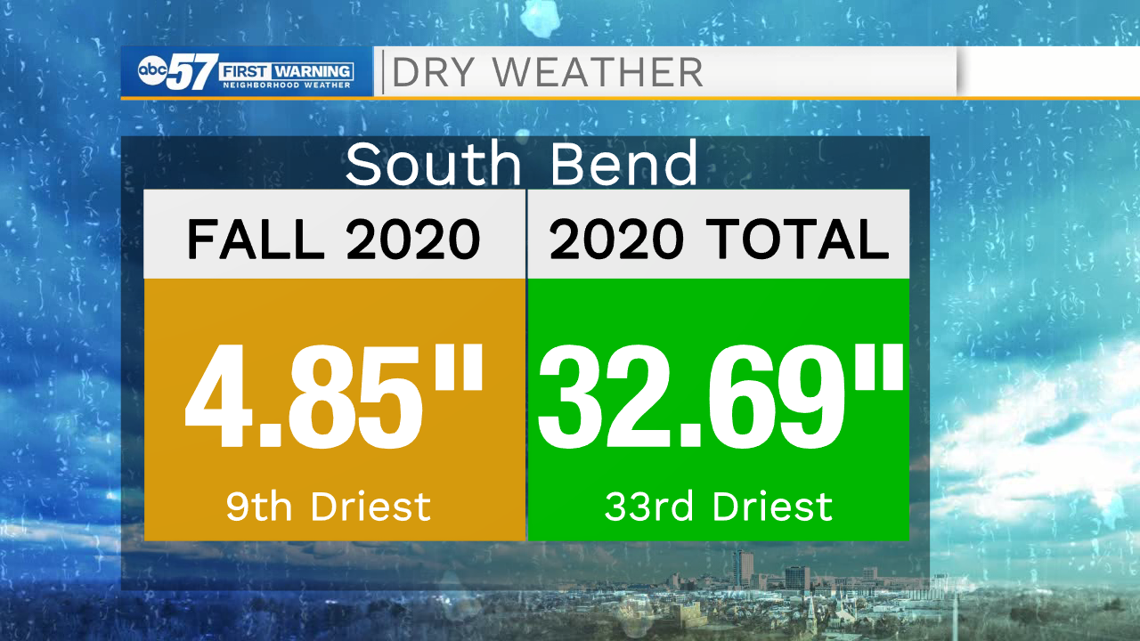
Right now, South Bend is on pace for a top 10 driest fall and a top 40 driest year.
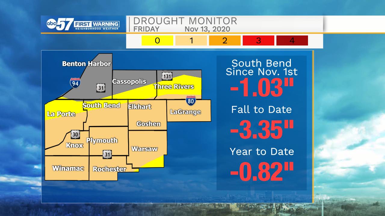
The relatively dry start to November and the historically warm temperatures lead to drought expanding across northern Indiana in the latest update.
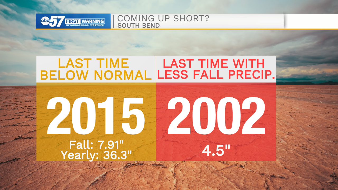
The last time we had this dry of a fall (if the season ended today) was 2002.
We have two more weeks to add to our rain/snow totals, with above normal precipitation favored for the rest of the month.
However, Michiana needs a few major rainfall events to make up a deficit of this magnitude.