Daytime Saturday is dry; rainy and windy starting Saturday evening


It’s a cool start to the weekend. Temperatures this morning are in the mid 20s: make sure to grab a hat and gloves before you head out the door. You’ll likely see frost on your windshield this morning, so plan on giving yourself extra time to scrape it off. There are some areas of patchy fog this morning. Remember to slow down if you are driving through fog and use low beam lights.
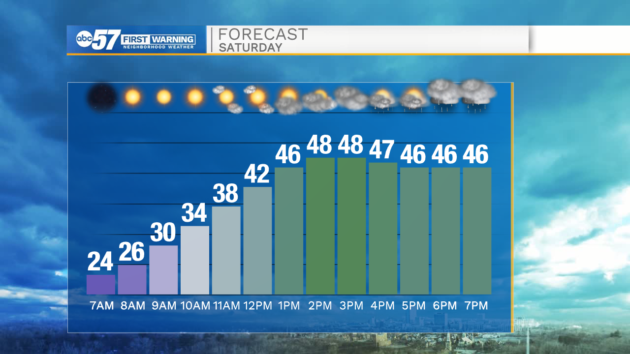
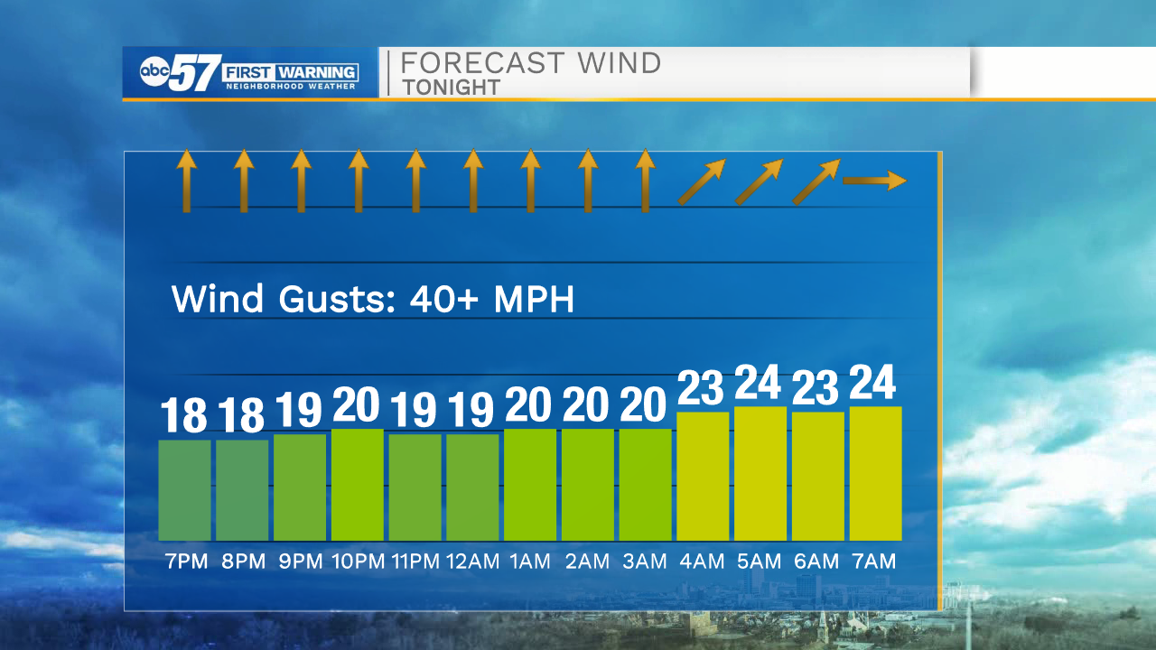
This afternoon clouds increase as temperatures warm to the upper 40s. There are a few isolated rain showers from 2 – 5 p.m. Most rain holds off until after 5 p.m. Tonight is rainy with a chance for a few isolated thunderstorms.
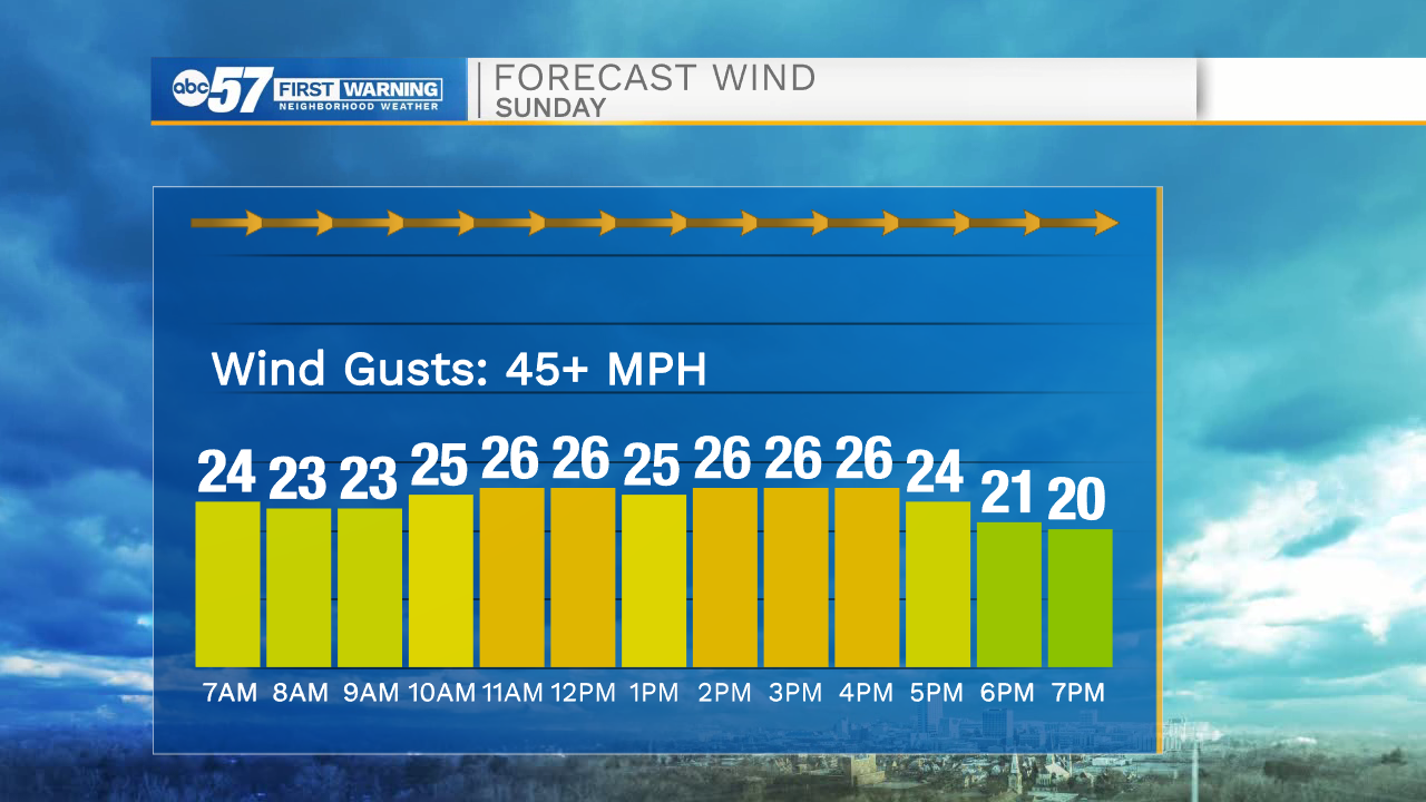
It will be quite windy both overnight and throughout the day Sunday.
Wind gusts 45+ mph are possible. While no severe weather is expected, a few isolated damaging wind gusts are possible.
Make sure to secure any outdoor decorations. There is a lakeshore flood advisory Sunday along Lake Michigan as waves could build 6 - 10 feet tall.
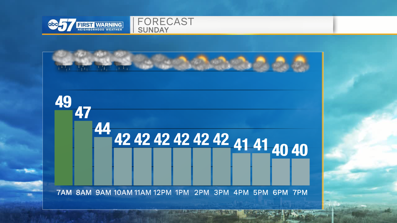
While it will be windy throughout the entire day, rain tapers off by noon Sunday. Temperatures fall from the upper 40s Sunday morning to the low 40s Sunday afternoon. Skies clear late.
Weather this work week doesn't look quite as active; it should stay dry Monday through Friday.
Today: Increasing clouds. Evening rain showers. Breezy. High 48.
Tonight: Rain, chance isolated thunderstorm, gusty winds. Low 43.
Sunday: Rain before noon. Windy. Mostly cloudy skies. Falling temperatures, steady in the low 40s by afternoon.
Monday: Mostly sunny. Breezy. High 50.