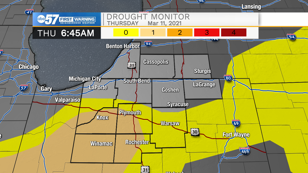
Current Michiana rainfall deficit and drought monitor


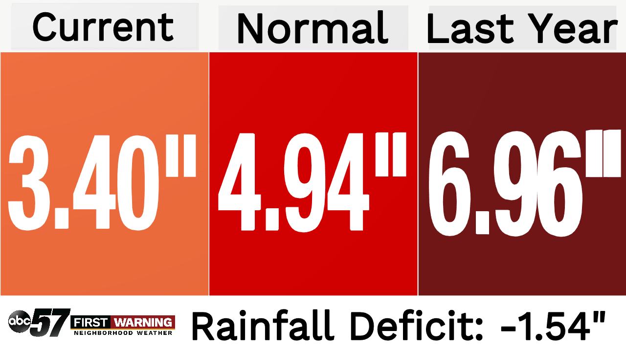
This year we have only seen a few rain showers move through the Michiana area. Right now our total accumulation stands at 3.40 inches. This puts us under our normal value of 4.94 inches by -1.54. Last year at this time we already received 6.96 inches of rainfall.
What does this mean for our drought situation here in Michiana? Right now we are seeing low end drought conditions already move into southern and central Michiana. As we wrap up the winter season and head into spring, farmers will begin taking to the fields to start planting. Ideally we want to be at the average or just above the amount of rainfall for this year before planting season begins. Then catch a week of dry weather in the beginning of May for farmers to get out in the fields and start the planting process.
Our rainfall deficit not only impacts farmers, but the possibility of unwanted fires being sparked and getting out of control. Coming out of the winter season along with the low rain amounts, more dead foliage becomes present. This in return is fuel that can allow a fire to get out of control fast. When we add in strong winds and low humidity, the fire weather danger becomes even more dangerous. So while we await the much needed rain, make sure to refrain from burning as much as possible.