
-
0:40

Marian High School hosts World Down Syndrome Awareness Walk
-
2:33

South Bend leaders call for an end to gun violence
-
2:01

Tae Johnson, Notre Dame secondary stands out as Irish open spring...
-
2:21

Backup quarterback competition, position battles highlight Notre...
-
2:25

A new Pathway to the Golden Dome
-
2:33

Howard Park aims to install bandshell
-
1:37

March Madness and gambling responsibly
-
1:19

There are two big temperatures drops next week
-
1:48

Longer days for the first day of Spring
-
1:30

Country music star Jake Owen to play at Blue Gate Performing...
-
1:51

Warm and sunny stretch with a few showers possible this weekend
-
0:30

Prayer vigil held for domestic violence victim in South Bend

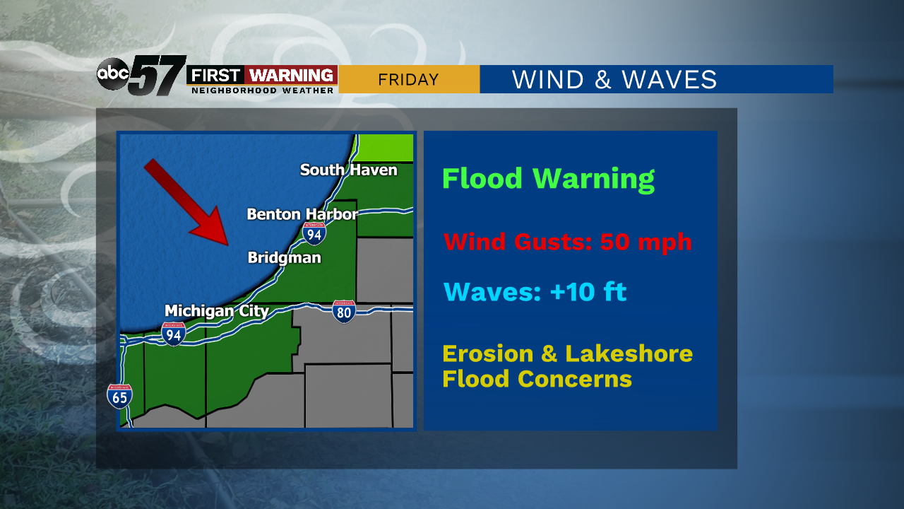
Tonight rain showers turn to a wintry mix, then turn to snow showers as temperatures drop. Snow continues Friday morning. While some areas will not see much of an accumulation, areas in the northwest could see an inch or more of snow. Friday is breezy and chilly, with gusts as high as 50 miles per hour in the morning. The high is 36 degrees. The weekend will be warmer with sunshine both Saturday and Sunday. By Monday, there is another chance for rain but temperatures stay in the 50s.
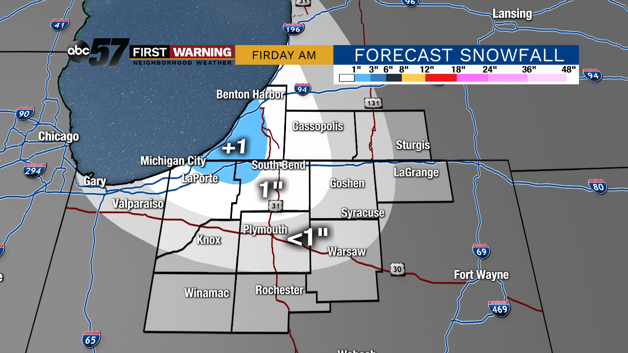
Tonight: Cloudy with rain/snow mix, then snow. Low 32.
Friday: Morning flurries, breezy, and mostly cloudy. High 36.
Saturday: Sunny. High 48.
Sunday: Mostly sunny. High 58.
Sign up for the ABC 57 Newsletter