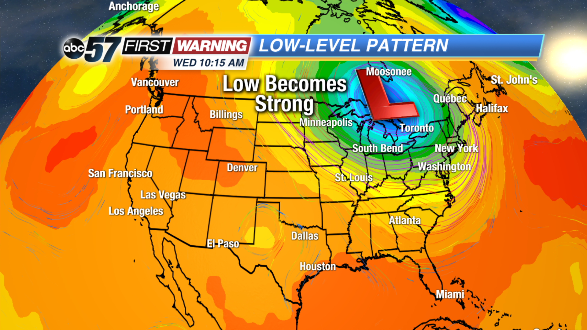
Hopefully you're O.K. with the recent dreary conditions because they simply aren't going anywhere for the next week, if not longer. We are stuck in a pattern that supports constant rain chances, plenty of cloud cover, breezy winds, and cool temperatures in the Midwest, Great Lakes, Ohio Valley, and Northeast. These areas continue to see low pressure system after low pressure system move through. The result? Plenty of rain in the forecast. That is the case for Wednesday night, Thursday and Friday as a strong area of low pressure will lift north from Tennessee into Ohio and southern Canada, bringing heavy rain and flooding to locations along the Ohio River.
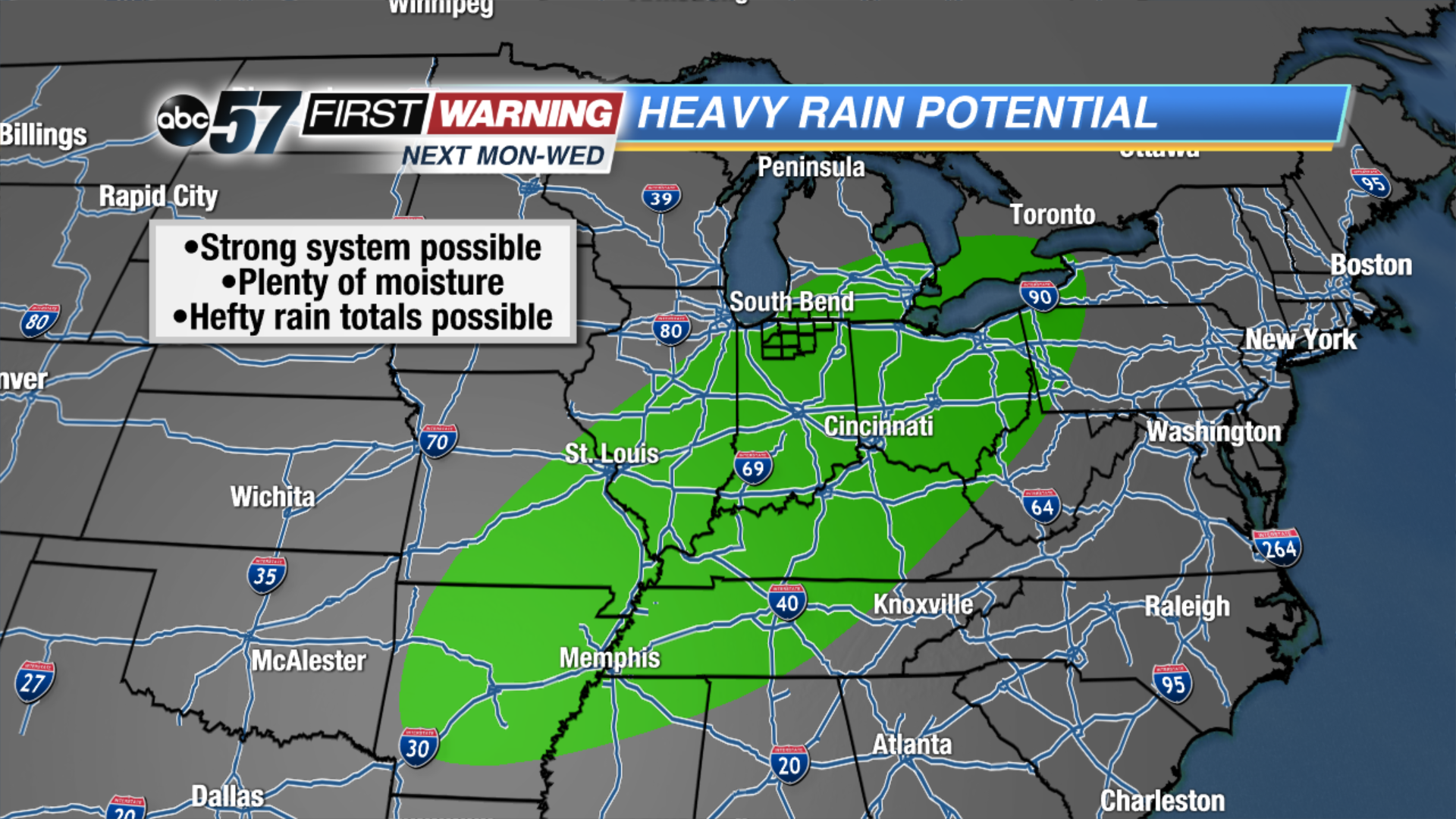
In Michiana, we will likely see at least some rain Thursday and Thursday night, especially south of the Toll Road and east of US 31. Flooding is not going to be a problem here. Another system -- possibly two -- is set to push into the Great Lakes region Sunday into Monday. This will bring another chance of rain and breezy conditions to much of the region late Sunday through Tuesday. It's difficult to pinpoint exactly when and where the heaviest rain will fall at this juncture because there are a lot of moving pieces with the set-up. However, confidence in a system impacting our weather early next week is very high as the pattern stays active.
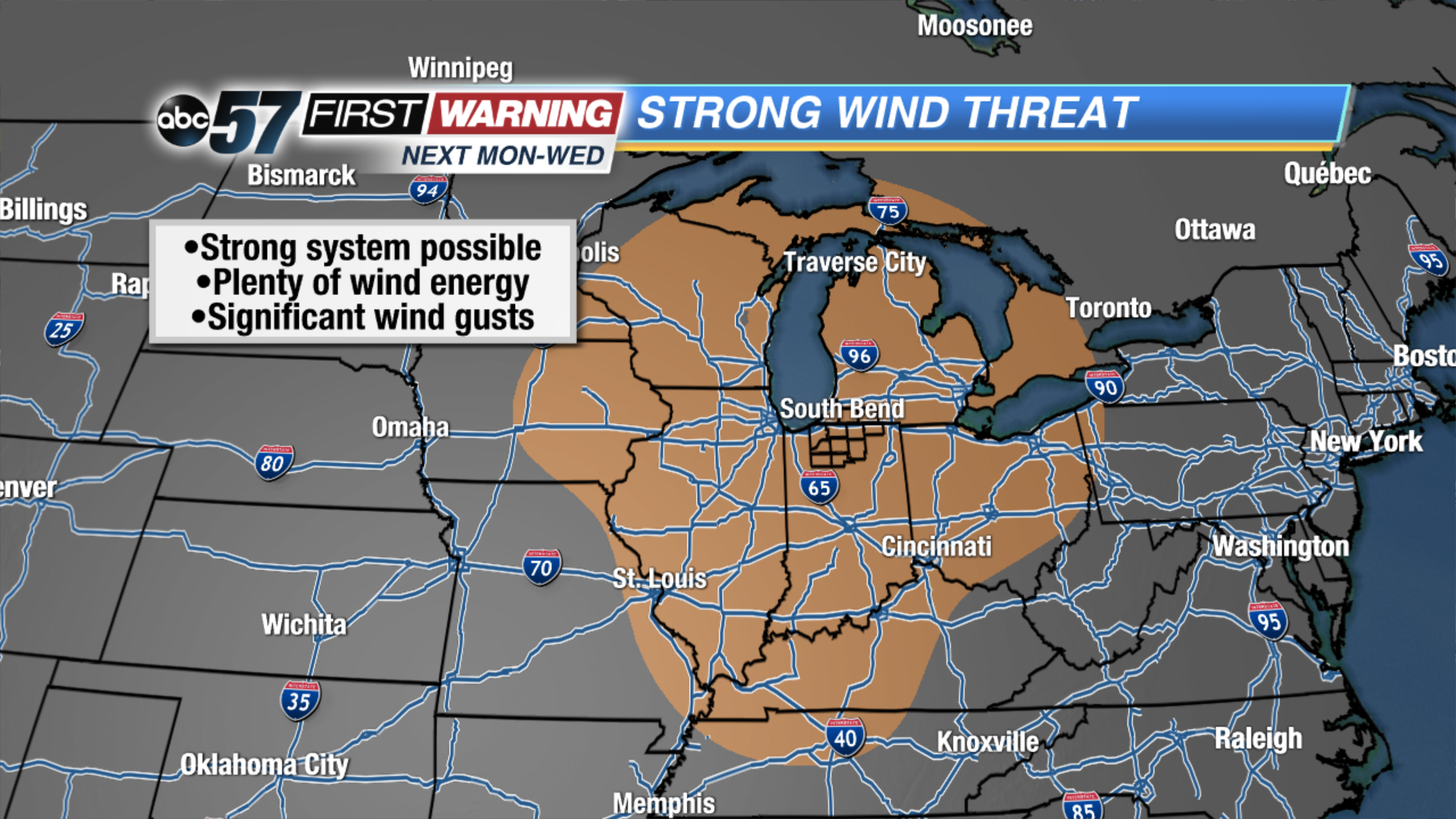
The zone of heaviest rain isn't the only aspect that we are watching carefully. If a stronger are of low pressure does indeed materialize, the threat would exist for some gusty winds during this stretch as well. Of course, the area most likely to witness strong wind gusts is nowhere near set in stone as medium-range forecast models continue exhibiting back-and-forth trends. One night the Great Lakes is in the zone of stronger winds. The next night models have the Mid-Atlantic and Northeast in the zone of strongest winds. These details will iron themselves out over the next couple of days, but one thing is for certain: the pattern will stay cloudy, rainy at times and cooler-than-normal overall. There's even good agreement on a significant cooldown late next week! Stay tuned!