 Significant storm system to develop and impact the Midwest, Great Lakes and Ohio Valley this weekend.
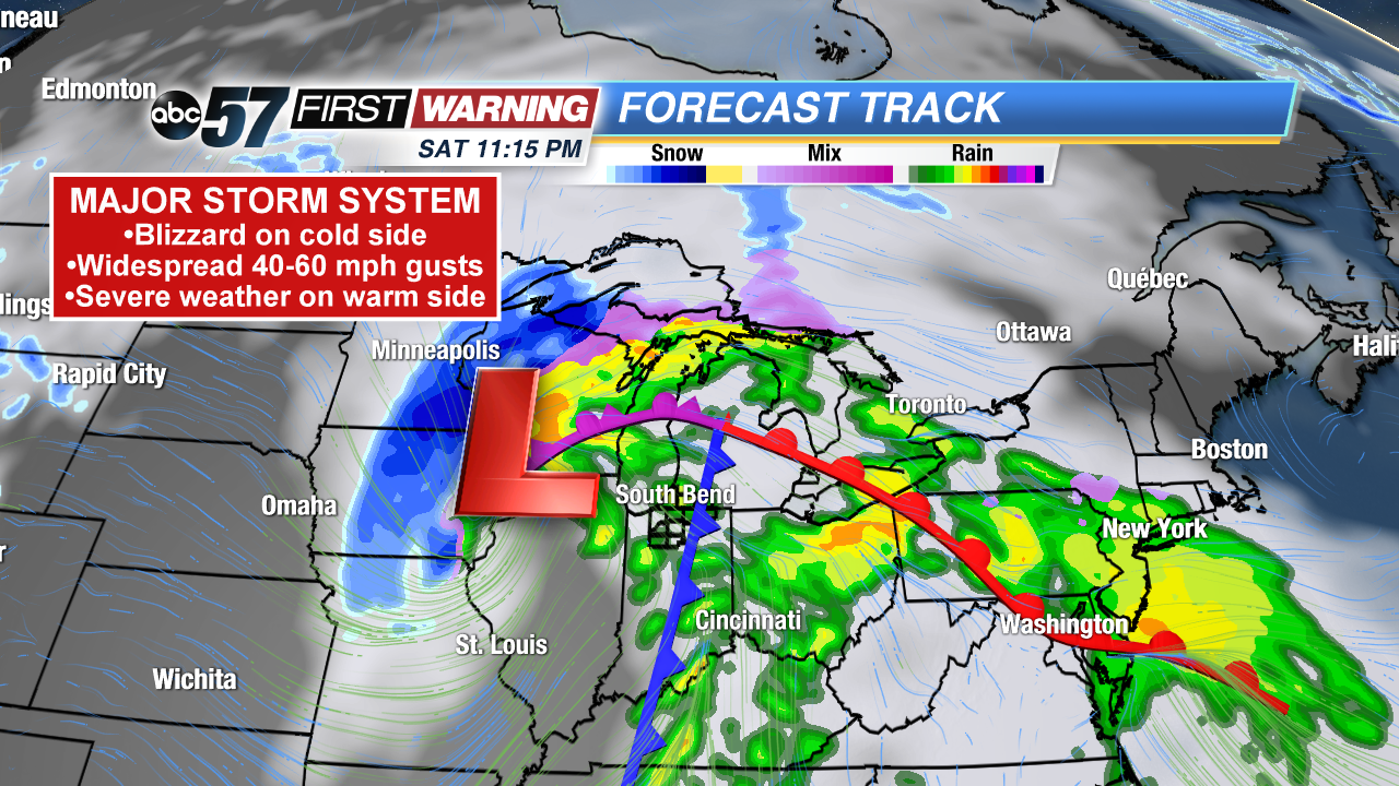
A very strong, potent storm system will develop in the Plains and race across the Midwest and Great Lakes this weekend. Its central pressure could fall as low as 975-980 millibars, which is equivalent to a strong category 1 hurricane. Everyone in its path will be impacted by one or more of the following:
•Very strong winds
•Rain, some heavy
•Thunderstorms
•Significant severe weather (damaging winds, tornadoes)
•Blizzard conditions
For us, we're likely to see the first three. However, depending on the eventual track of the system, a low severe risk could be in play with damaging wind gusts being the main threat Saturday evening. Regardless of the severe risk, we will certainly see some rain, rumbles of thunder and very strong wind gusts.
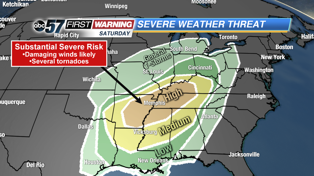 Severe weather risk Saturday and Saturday night.
SPC
Severe weather risk Saturday and Saturday night.
SPC
The rain risk will be highest Saturday afternoon into the early overnight hours. The thunderstorm risk will be at its peak Saturday evening. That is also when the low-end severe threat would exist if it develops. Temperatures will be chilly all day, but will quickly surge well into the 50s during the late evening hours. This is why the thunderstorm risk peaks after 7 p.m. Fortunately, we are dodging the likely significant severe weather event expected to unfold across parts of Arkansas, Louisiana, Mississippi, Alabama, Tennessee, Missouri, and Kentucky. Widespread damaging wind gusts and several tornadoes are expected in these states.
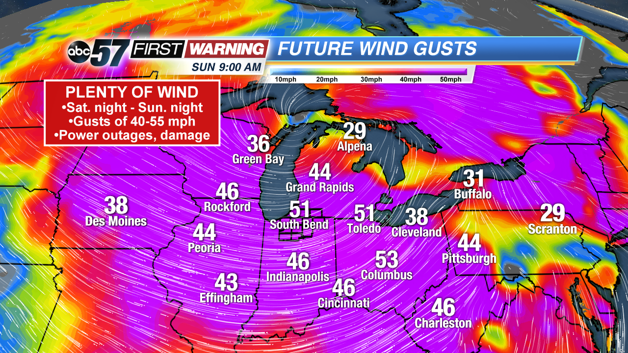 Potential wind gusts Sunday at 9 a.m.
Some of the damaging wind gusts could exceed 70 mph and cause significant damage. The Storm Prediction Center is also warning of the potential for a few strong/intense tornadoes. Again, that activity will stay south of I-70. A few rain showers are likely Saturday night into Sunday morning before switching to snow showers. The bigger story, though, will be the big-time uptick in wind energy by 2 a.m. Sunday. Wind gusts will increase all night into Sunday afternoon. And it's not just us here in Michiana. Strong to very strong wind gusts of 40-55 mph are likely across a good chunk of the Midwest and Great Lakes.
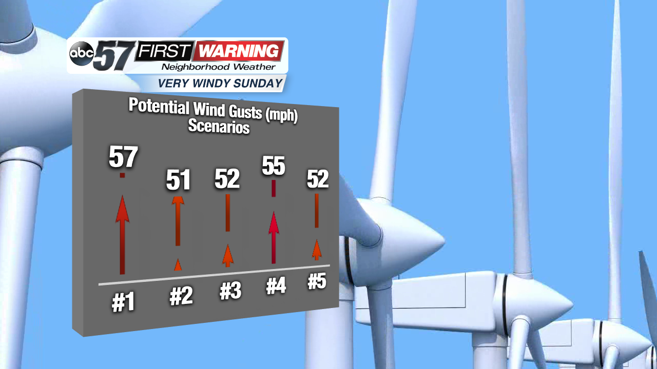 Peak wind gust potential for South Bend according to 5 different forecast models.
How strong exactly are the wind gusts expected to be here? Put simply, very strong. The potential exists for the entire Michiana area to see wind gusts over 50 mph. Some data even suggests that gusts of 55-60 mph are very possible Sunday morning and early afternoon. For perspective, wind gusts over 58 mph are considered "severe." Numerous power outages and even some damage to trees and structures are possible.
