


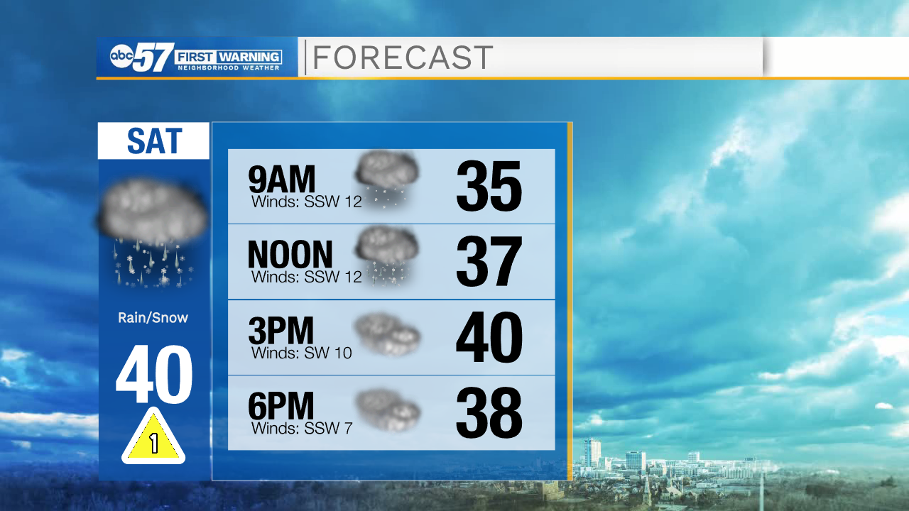
It’s a wet start to the weekend. This morning there’s a mix of scattered snow and rain showers. Our northern counties could pick up a tenth of an inch of snow, but there should be little impact on travel. The showers will likely be off and on throughout the day, and they will never become widespread. Most of the precipitation turns to a wintry mix then rain showers by late morning, so be sure to grab an umbrella if you are heading out for the day.
Temperatures climb from the mid 30s this morning to a high around 40 this afternoon. Overnight skies stay mostly cloudy, so temperatures won’t cool too much, with a low around 32.
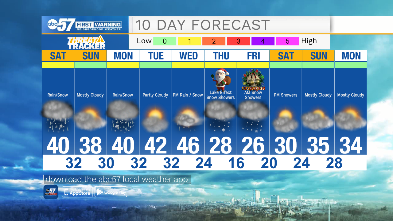
Sunday should stay dry with a high in the upper 30s- this will be the better day of the weekend to head out for last minute Christmas shopping.
Monday there is another snow / rain mix, but little impacts are expected again. Enjoy mild days Tuesday and Wednesday with highs in the mid 40s.
Much cooler air is on the way starting Christmas Eve, with a high of 28 on Thursday. There is a chance for snow showers Thursday and Friday, so we could have a white Christmas.
Today: Mostly cloudy with scattered snow / rain showers. High 40.
Tonight: Mostly cloudy. Low 32.
Sunday: Mostly cloudy. High 38.
Monday: Mostly cloudy. Snow / rain showers. High 40.