
-
1:07

Fresh air out the door, Still a little humid
-
1:35

Scouts BSA Troop 541 of Buchanan celebrates centennial anniversary
-
2:39

Canadian wildfire smoke prompts precautions at South Bend Cubs...
-
5:27

ABC57’s Brian Conybeare factchecks President’s voter fraud...
-
1:40

OSMC holds annual wellness event at new Granger location
-
2:20

Jazz Fest Encore and fireworks slated for Saturday in Downtown...
-
3:15

ISP Trooper shot during car chase last week released from hospital
-
1:43

Storms to clear the air of smoke
-
1:31

When will Air Quality Improve?
-
1:32

Hazardous Air Quality to start the day
-
0:54

Serious crash leaves one dead on South Bend’s northwest side
-
1:25

New Buffalo vacationers and residents feel the effects of poor...

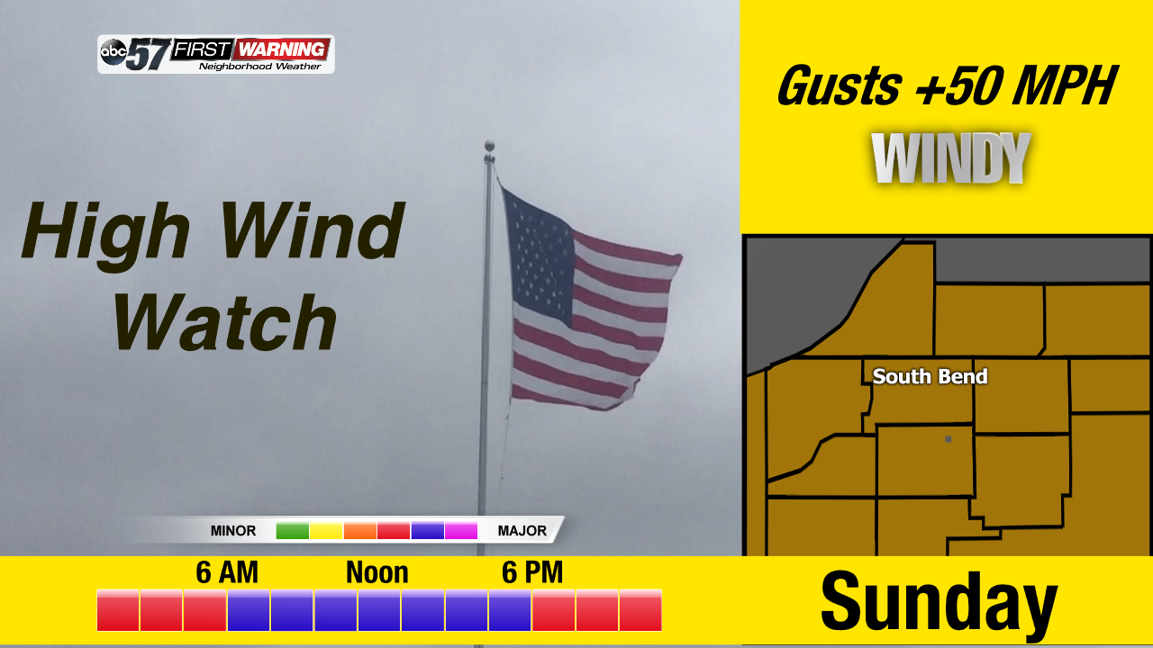
The weather only gets worse through Sunday. Temperatures warm into the 40s Saturday, spiking near 50 before plummeting after midnight. Rain is likely Saturday afternoon through early Sunday before changing to sleet and snow. The big story however is wind. Sunday’s weather is a high impact wind storm. A sustained wind of 30 and gusts of more than 50 mph will last all day. The wind will start to calm into Monday morning.
Tonight: Mostly cloud, low of 32.
Saturday: Rain likely by the afternoon, low 40s spiking to 50 around midnight.
Sunday: Extremely windy, temperatures falling from 40, rain and snow showers.
Monday: Partly cloudy, breezy, high of 28.
Sign up for the ABC 57 Newsletter