
-
1:17

Cold and soaking rain today, another severe risk tomorrow
-
0:44

South Bend High School Music Festival highlights student talent
-
1:55

South Bend house fire possibly caused by lightning
-
2:26

Flooding remains a threat into Wednesday
-
0:40

Baxmeyer defends actions amid solar farm bond debate
-
2:11

Southwest Michigan Cares Fund reaches over $70k as families still...
-
1:35

Severe weather threat ending across Michiana
-
0:51

SJCPD responds to AG’s appeal of lawsuit dismissal
-
2:13

More strong storms likely this evening
-
2:15

The ingredients for severe weather
-
2:14

Why summer travel prices may spike due to the ongoing war in...
-
1:49

Heavy rain, high winds, and hail are main severe concerns today

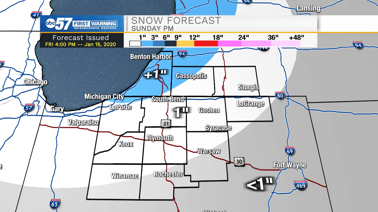
Scattered snow showers last through the weekend with little accumulation expected, mostly because high temperatures remain above freezing. The best chance of accumulation comes Sunday afternoon / evening with an inch or so possible on the grass. Pavement most likely stays wet. True winter cold remains elusive through next week, highs hold near the freezing mark, in a quiet winter pattern.
Tonight: Flurries. Low 26.
Saturday: Scattered snow showers. High 36.
Sunday: Scattered snow showers. High 34.
Monday: Mostly cloudy. High 32.
Sign up for the ABC 57 Newsletter