
-
1:43

Pleasant to start the weekend
-
3:06

Pulaski County weighs stricter solar rules amid resident concerns
-
0:40

Marian High School hosts World Down Syndrome Awareness Walk
-
2:33

South Bend leaders call for an end to gun violence
-
2:01

Tae Johnson, Notre Dame secondary stands out as Irish open spring...
-
2:21

Backup quarterback competition, position battles highlight Notre...
-
2:25

A new Pathway to the Golden Dome
-
2:33

Howard Park aims to install bandshell
-
1:37

March Madness and gambling responsibly
-
1:19

There are two big temperatures drops next week
-
1:48

Longer days for the first day of Spring
-
1:30

Country music star Jake Owen to play at Blue Gate Performing...

ABC57 First Warning Neighborhood Weather Forecast
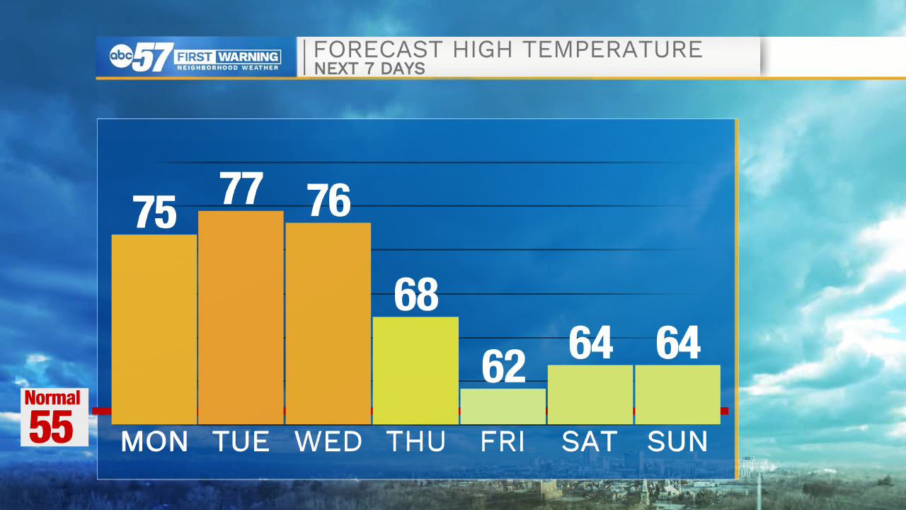
Monday, April 5th, 2021
The stretch of warmth with daytime highs in the 70s continues through mid-week! Isolated t-storms are possible today and Tuesday with storms arriving late Wednesday evening. Showers become more widespread for Thursday as daytime highs drop into the upper 60s. A few showers could linger into Friday morning. Daytime highs remain in the 60s through the weekend with more sunshine.
Today: Mix of sun and clouds. Isolated t-storms and breezy. High 75.
Tonight: Partly cloudy. Low 56.
Tuesday: Partly cloudy. Isolated t-storms. High 77.
Wednesday: Increasing clouds. Storms late. High 76.
Sign up for the ABC 57 Newsletter