The warm-up Thursday, before temperatures crash Friday
By:
Tom Coomes
Posted: Oct 21, 2020 4:12 PM EDT

-
0:34

South Bend Community Review Board hosts open discussion on youth...
-
2:19

INDOT walks through a proposed diverging diamond intersection...
-
1:08

Notre Dame’s Leonard Moore highlights student success and raises...
-
1:05

Mayflower Bridge set to close beginning April 6
-
0:21

Colfax Avenue eastbound lane closed for water and sewer work
-
0:46

Madison Street closed for lifestyle district project
-
4:11

Non-profit organization provides deep dive into Blackstone, a...
-
1:52

Storms possible overnight, strong storms by Tuesday evening
-
3:48

New partnership aims to help fight food insecurity across Elkhart...
-
2:00

A sunny Monday ahead, rainy almost every other day this week
-
2:59

Dusty May leads Michigan back to Final Four with dominant win...
-
0:37

Vendors and cosplayers showcase art at South Bend Anime Fest

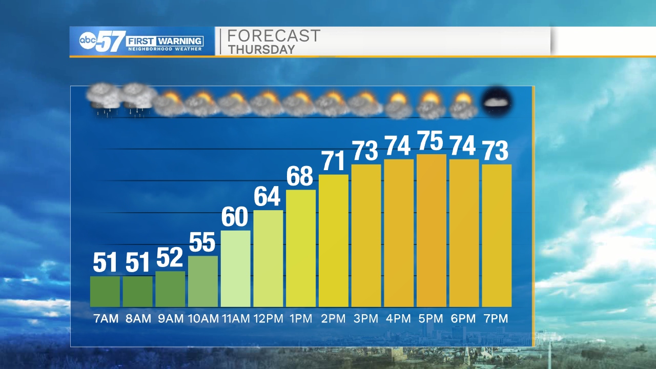
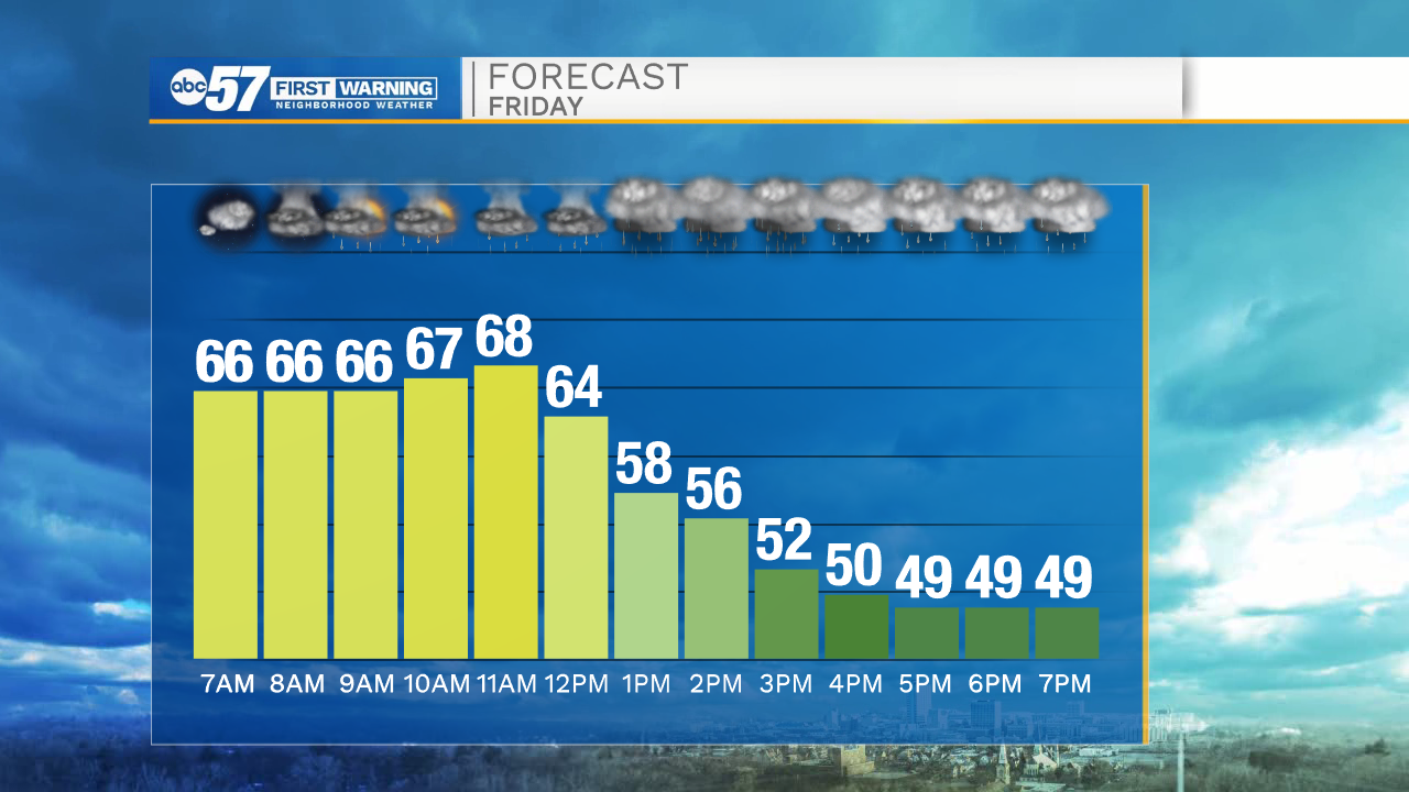
Scattered showers start Thursday ahead of a quick warm-up. The wind turns southerly and temperatures spike into the mid-70s. Thursday night is mild ahead of the advancing cold front that will drop temperatures suddenly midday Friday. A near 20-degree drop is possible from noon to mid-afternoon. Scattered showers and storms are likely, damaging severe weather is unlikely but blustery wind is also likely. The weekend is cool again with highs in the 50s.
Tonight: Scattered showers late. Mostly cloudy. Low 48.
Thursday: AM showers. Partly cloudy, breezy, warm. High 75.
Friday: Temperatures fall from 70 midday. Scattered showers/storms, gusty wind.
Saturday: Partly cloudy. High 52.
Sign up for the ABC 57 Newsletter