The track matters: A look at Monday's snow potential

-
2:34

Warm to start the week, Rainy week ahead
-
2:44

Warmer, breezier, and cloudier than yesterday
-
0:46

Crowds gather for Fins and Feathers Fest at La Porte City Fairgrounds
-
0:46

Paramount School of Excellence hosts teacher fair
-
2:30

Voting advocacy, peaceful demonstrations and donations: South...
-
2:04

Warming to start the week, Showers and storms by Tuesday
-
2:10

Cool, but calm, today
-
1:23

City of South Bend presents an ’Age-Friendly Plan’ to better...
-
0:54

South Bend Venues Parks and Arts hosts ’Adult Recess’
-
2:27

Why Aneyas Williams turned down the transfer portal and stayed...
-
2:21

Bourbon community rallies around Triton boys’ basketball team...
-
5:02

Dave Matthews shares details about LLC bankruptcy filings

Little change in the weather through Friday. Saturday the region will be brushed by a stronger system to the east, bringing a chance of drizzle or flurries, damp and dreary either way. Sunday is cooler, a lull before a storm moves into the Ohio Valley Monday. Confidence is growing there will be some snow. The track of the low will dictate how big of a snow factor the area receives.
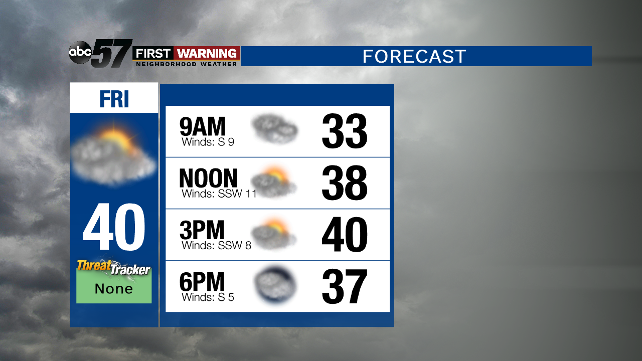
Tonight: Mostly cloudy. Low of 32.
Friday: Mostly cloudy. High of 40.
Saturday: Cloudy. Chance of light rain and/or snow. High of 38.
Sunday: Mostly cloudy. High of 30.
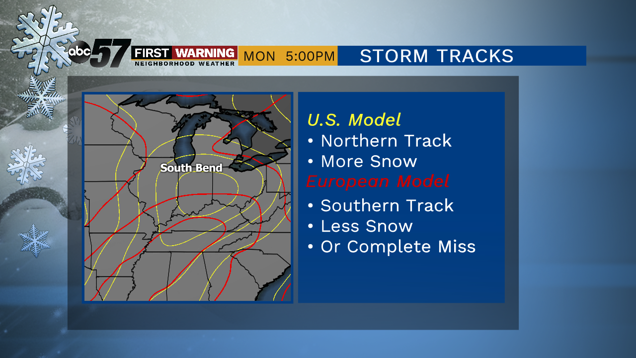
Models are showing more agreement of an Ohio Valley storm track, this would likely bring snow to Michiana.
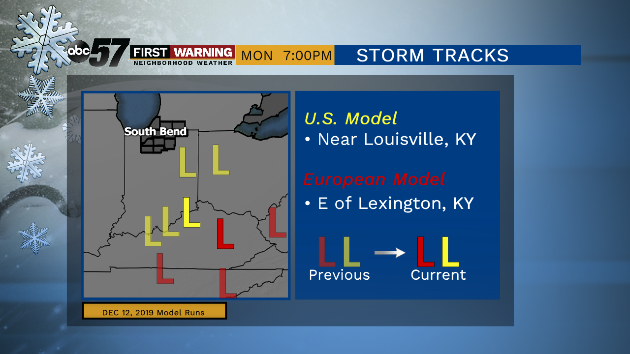
The European model has been most consistent with its performance to date. We are currently favoring 'EURO' but not ignoring the U.S. GFS model.