Sunny start to weekend; rain and thunderstorms on the way


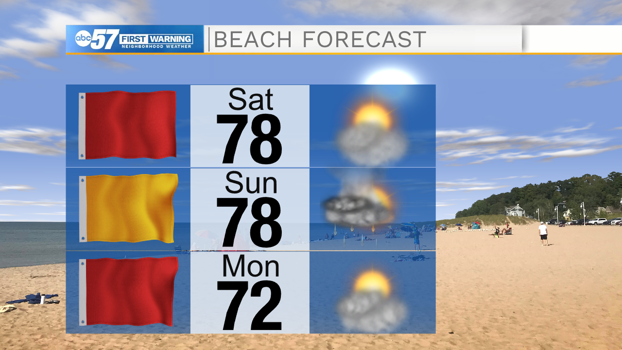
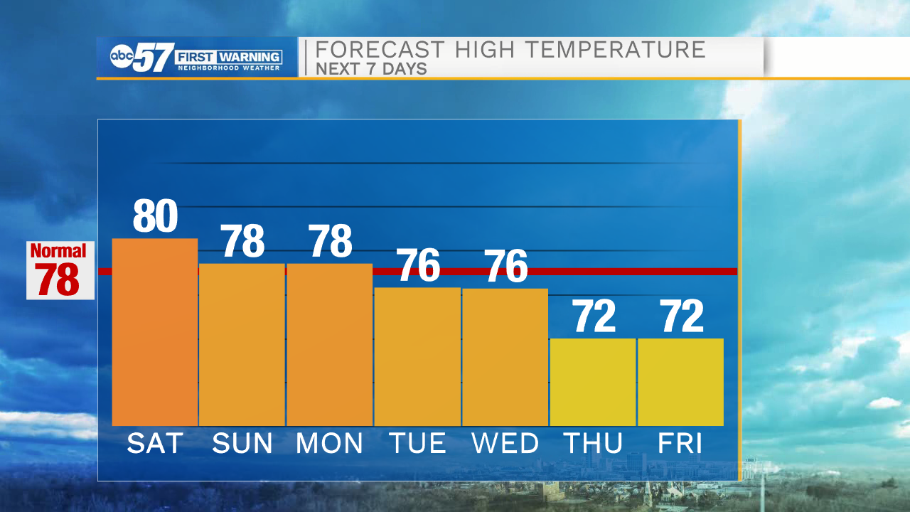
Enjoy a fair, mostly sunny Saturday to start the three-day weekend. Temperatures start in the mid 50s this morning, then climb to the low 70s by lunchtime. We reach a high around 80 degrees this afternoon. Skies are mostly sunny, with a few more clouds developing later this afternoon. It will be breezy today with wind gusts 20+ miles per hour possible. This afternoon, wind switches direction and will blow from the north, which leads to bigger waves this afternoon and evening on Lake Michigan. While it is a beautiful sunny day, don’t plan on swimming with waves three to five feet and a red flag flying.
Overnight it’s mostly clear with a low around 52.
Take advantage of the sunshine today, as we enter a rainy period starting Sunday. We could see a few showers and thunderstorms Sunday afternoon, but a lot will hold off until the overnight hours. Sunday reaches a high around 78. On Labor Day Monday, there are a few showers early, then it’s a mostly cloudy day with chances for afternoon thunderstorms.
The rest of the week looks unsettled with rain and thunderstorm chances continuing Tuesday through Thursday. Temperatures slowly become more “fall-like” this week, dropping from highs in the upper 70s earlier in the week to highs around 70 by the end of the week.
Today: Mostly sunny, breezy. High 80.
Tonight: Mostly clear. Low 52.
Sunday: Isolated storms. Scattered storms overnight. High 78.
Labor Day Monday: Isolated storms. High 78.